You are here: Home > Network List > PF - Volcanologic Network of Piton de Fournaise-OVPF Stations List
> Station HIM cratere Himiltrude > Earthquake Result Viewer
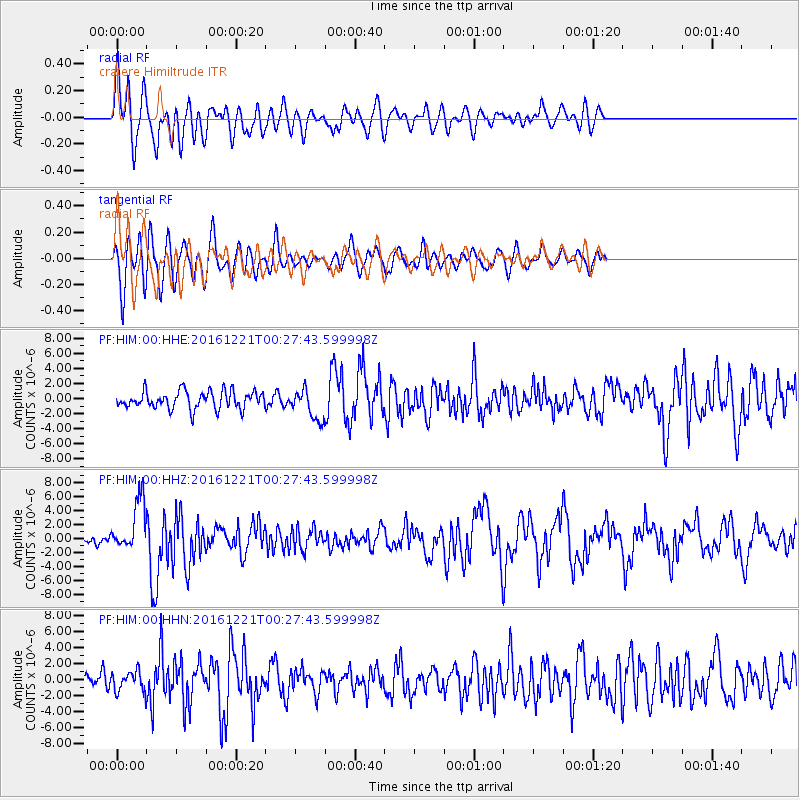
HIM cratere Himiltrude - Earthquake Result Viewer
*The percent match for this event was below the threshold and hence no stack was calculated.
| Earthquake location: |
Banda Sea |
| Earthquake latitude/longitude: |
-7.5/127.9 |
| Earthquake time(UTC): |
2016/12/21 (356) 00:17:15 GMT |
| Earthquake Depth: |
152 km |
| Earthquake Magnitude: |
6.7 Mww |
| Earthquake Catalog/Contributor: |
NEIC PDE/us |
|
| Network: |
PF Volcanologic Network of Piton de Fournaise-OVPF |
| Station: |
HIM cratere Himiltrude |
| Lat/Lon: |
21.21 S/55.72 E |
| Elevation: |
1958 m |
|
| Distance: |
70.7 deg |
| Az: |
250.214 deg |
| Baz: |
90.72 deg |
| Ray Param: |
$rayparam |
*The percent match for this event was below the threshold and hence was not used in the summary stack. |
|
| Radial Match: |
79.87679 % |
| Radial Bump: |
400 |
| Transverse Match: |
79.731064 % |
| Transverse Bump: |
400 |
| SOD ConfigId: |
1894071 |
| Insert Time: |
2017-01-04 00:19:26.815 +0000 |
| GWidth: |
2.5 |
| Max Bumps: |
400 |
| Tol: |
0.001 |
|
Signal To Noise
| Channel | StoN | STA | LTA |
| PF:HIM:00:HHZ:20161221T00:27:43.599998Z | 4.25533 | 3.7015232E-6 | 8.698557E-7 |
| PF:HIM:00:HHN:20161221T00:27:43.599998Z | 0.91498595 | 1.2086313E-6 | 1.3209287E-6 |
| PF:HIM:00:HHE:20161221T00:27:43.599998Z | 1.699037 | 1.9706276E-6 | 1.1598498E-6 |
| Arrivals |
| Ps | |
| PpPs | |
| PsPs/PpSs | |


