You are here: Home > Network List > TA - USArray Transportable Network (new EarthScope stations) Stations List
> Station M16K Timber Creek, AK, USA > Earthquake Result Viewer
M16K Timber Creek, AK, USA - Earthquake Result Viewer
*The percent match for this event was below the threshold and hence no stack was calculated.
| Earthquake location: |
Southeast Of Honshu, Japan |
| Earthquake latitude/longitude: |
32.8/140.6 |
| Earthquake time(UTC): |
2019/07/29 (210) 20:37:42 GMT |
| Earthquake Depth: |
53 km |
| Earthquake Magnitude: |
5.7 Mww |
| Earthquake Catalog/Contributor: |
NEIC PDE/us |
|
| Network: |
TA USArray Transportable Network (new EarthScope stations) |
| Station: |
M16K Timber Creek, AK, USA |
| Lat/Lon: |
61.02 N/158.96 W |
| Elevation: |
394 m |
|
| Distance: |
47.7 deg |
| Az: |
34.976 deg |
| Baz: |
262.277 deg |
| Ray Param: |
$rayparam |
*The percent match for this event was below the threshold and hence was not used in the summary stack. |
|
| Radial Match: |
70.513336 % |
| Radial Bump: |
400 |
| Transverse Match: |
74.56506 % |
| Transverse Bump: |
400 |
| SOD ConfigId: |
19053131 |
| Insert Time: |
2019-08-12 20:48:02.024 +0000 |
| GWidth: |
2.5 |
| Max Bumps: |
400 |
| Tol: |
0.001 |
|
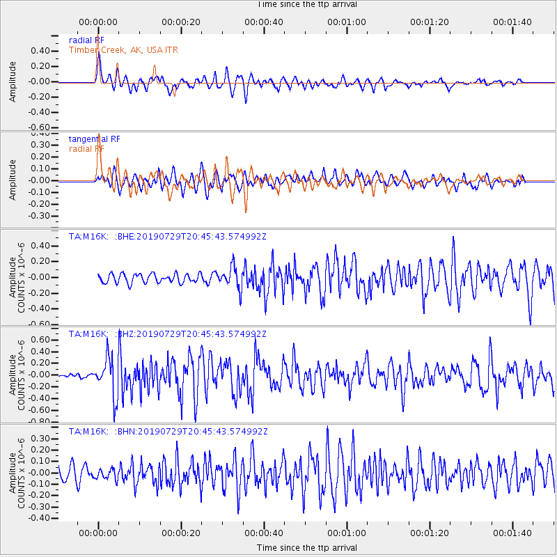
Signal To Noise
| Channel | StoN | STA | LTA |
| TA:M16K: :BHZ:20190729T20:45:43.574992Z | 8.301958 | 3.3517077E-7 | 4.0372495E-8 |
| TA:M16K: :BHN:20190729T20:45:43.574992Z | 0.6272826 | 4.4000554E-8 | 7.01447E-8 |
| TA:M16K: :BHE:20190729T20:45:43.574992Z | 2.4886034 | 1.3960847E-7 | 5.6099125E-8 |
| Arrivals |
| Ps | |
| PpPs | |
| PsPs/PpSs | |


