You are here: Home > Network List > US - United States National Seismic Network Stations List
> Station HAWA Hanford, Washington, USA > Earthquake Result Viewer
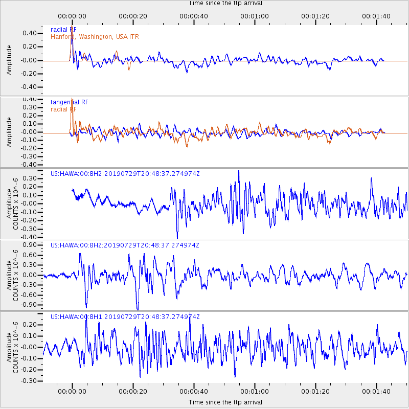
HAWA Hanford, Washington, USA - Earthquake Result Viewer
*The percent match for this event was below the threshold and hence no stack was calculated.
| Earthquake location: |
Southeast Of Honshu, Japan |
| Earthquake latitude/longitude: |
32.8/140.6 |
| Earthquake time(UTC): |
2019/07/29 (210) 20:37:42 GMT |
| Earthquake Depth: |
53 km |
| Earthquake Magnitude: |
5.7 Mww |
| Earthquake Catalog/Contributor: |
NEIC PDE/us |
|
| Network: |
US United States National Seismic Network |
| Station: |
HAWA Hanford, Washington, USA |
| Lat/Lon: |
46.39 N/119.53 W |
| Elevation: |
364 m |
|
| Distance: |
73.2 deg |
| Az: |
45.419 deg |
| Baz: |
299.972 deg |
| Ray Param: |
$rayparam |
*The percent match for this event was below the threshold and hence was not used in the summary stack. |
|
| Radial Match: |
73.29137 % |
| Radial Bump: |
400 |
| Transverse Match: |
64.55481 % |
| Transverse Bump: |
400 |
| SOD ConfigId: |
19053131 |
| Insert Time: |
2019-08-12 20:49:29.337 +0000 |
| GWidth: |
2.5 |
| Max Bumps: |
400 |
| Tol: |
0.001 |
|
Signal To Noise
| Channel | StoN | STA | LTA |
| US:HAWA:00:BHZ:20190729T20:48:37.274974Z | 5.8112926 | 3.6170357E-7 | 6.22415E-8 |
| US:HAWA:00:BH1:20190729T20:48:37.274974Z | 1.9810952 | 1.04815804E-7 | 5.290801E-8 |
| US:HAWA:00:BH2:20190729T20:48:37.274974Z | 2.0591168 | 1.3960536E-7 | 6.779866E-8 |
| Arrivals |
| Ps | |
| PpPs | |
| PsPs/PpSs | |


