
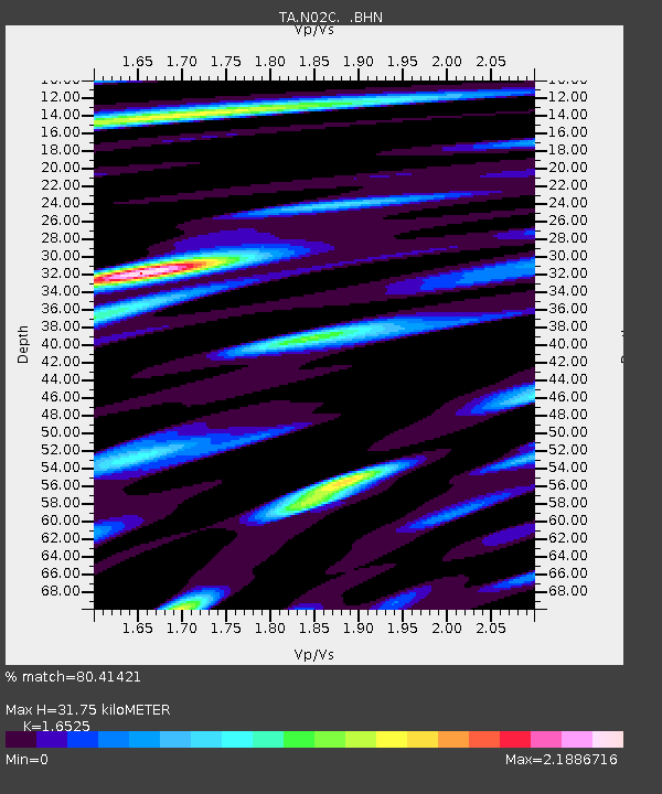
N02C Big Bar, CA, USA - Earthquake Result Viewer
| ||||||||||||||||||
| ||||||||||||||||||
| ||||||||||||||||||
|
Signal To Noise
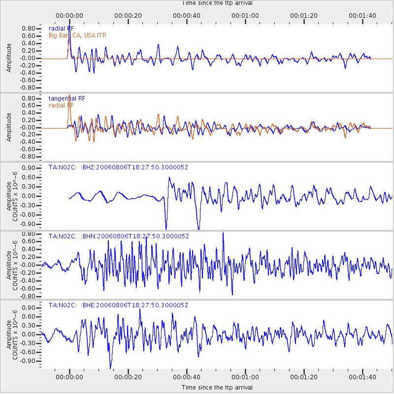
| Channel | StoN | STA | LTA |
| TA:N02C: :BHN:20060806T18:27:50.300005Z | 1.8078433 | 1.7741053E-7 | 9.8133796E-8 |
| TA:N02C: :BHE:20060806T18:27:50.300005Z | 2.8758347 | 2.4966488E-7 | 8.6814744E-8 |
| TA:N02C: :BHZ:20060806T18:27:50.300005Z | 4.1920795 | 3.8881262E-7 | 9.274934E-8 |
| Arrivals | |
| Ps | 3.3 SECOND |
| PpPs | 12 SECOND |
| PsPs/PpSs | 16 SECOND |

