You are here: Home > Network List > TA - USArray Transportable Network (new EarthScope stations) Stations List
> Station B18K Kokolik River, AK, USA > Earthquake Result Viewer
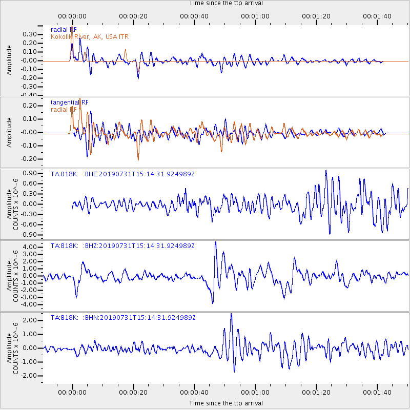
B18K Kokolik River, AK, USA - Earthquake Result Viewer
*The percent match for this event was below the threshold and hence no stack was calculated.
| Earthquake location: |
Vanuatu Islands |
| Earthquake latitude/longitude: |
-16.2/167.9 |
| Earthquake time(UTC): |
2019/07/31 (212) 15:02:33 GMT |
| Earthquake Depth: |
179 km |
| Earthquake Magnitude: |
6.6 mww |
| Earthquake Catalog/Contributor: |
NEIC PDE/us |
|
| Network: |
TA USArray Transportable Network (new EarthScope stations) |
| Station: |
B18K Kokolik River, AK, USA |
| Lat/Lon: |
69.36 N/161.80 W |
| Elevation: |
222 m |
|
| Distance: |
88.0 deg |
| Az: |
10.295 deg |
| Baz: |
208.976 deg |
| Ray Param: |
$rayparam |
*The percent match for this event was below the threshold and hence was not used in the summary stack. |
|
| Radial Match: |
86.82065 % |
| Radial Bump: |
400 |
| Transverse Match: |
75.505196 % |
| Transverse Bump: |
400 |
| SOD ConfigId: |
19053131 |
| Insert Time: |
2019-08-14 15:09:40.064 +0000 |
| GWidth: |
2.5 |
| Max Bumps: |
400 |
| Tol: |
0.001 |
|
Signal To Noise
| Channel | StoN | STA | LTA |
| TA:B18K: :BHZ:20190731T15:14:31.924989Z | 6.0906644 | 1.2959468E-6 | 2.1277594E-7 |
| TA:B18K: :BHN:20190731T15:14:31.924989Z | 2.751722 | 2.5583915E-7 | 9.29742E-8 |
| TA:B18K: :BHE:20190731T15:14:31.924989Z | 1.5582381 | 1.568618E-7 | 1.00666135E-7 |
| Arrivals |
| Ps | |
| PpPs | |
| PsPs/PpSs | |


