R07C Lee Vining, CA, USA - Earthquake Result Viewer
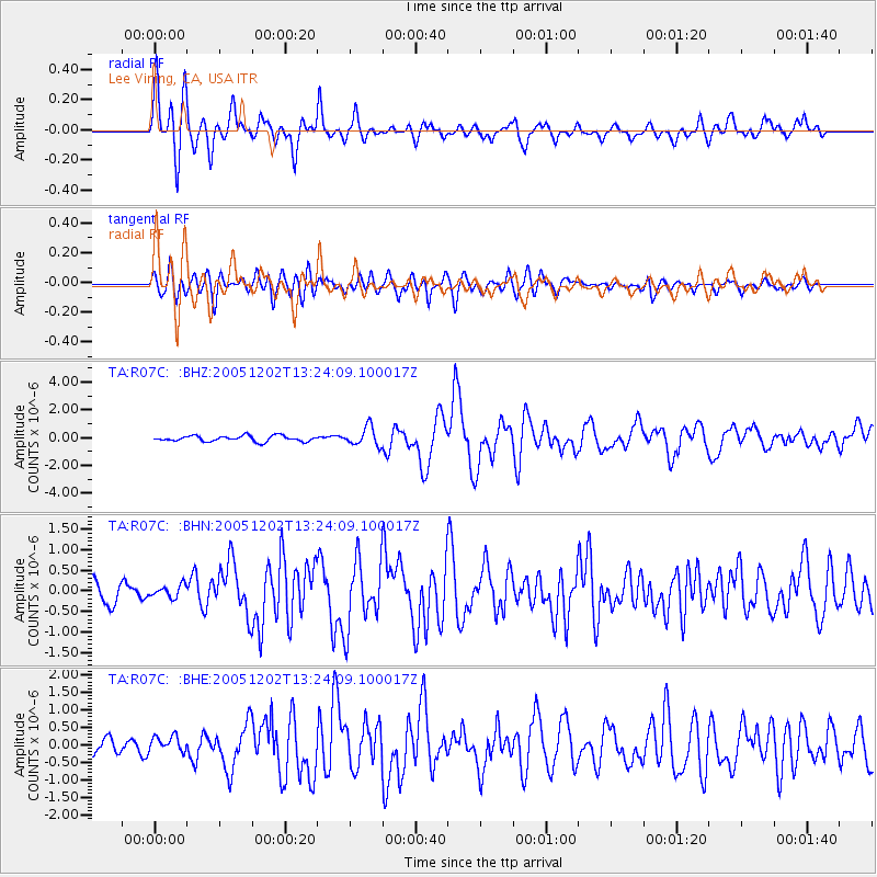
Earthquake location: Near East Coast Of Honshu, Japan
Earthquake latitude/longitude: 38.1/142.1
Earthquake time(UTC): 2005/12/02 (336) 13:13:09 GMT
Earthquake Depth: 29 km
Earthquake Magnitude: 6.1 MB, 6.3 MS, 6.5 MW, 6.4 MW
Earthquake Catalog/Contributor: WHDF/NEIC
Network: TA USArray Transportable Network (new EarthScope stations)
Station: R07C Lee Vining, CA, USA
Lat/Lon: 38.09 N/119.05 W
Elevation: 1996 m
Distance: 73.6 deg
Az: 54.355 deg
Baz: 305.645 deg
Ray Param: 0.0528354
Estimated Moho Depth: 40.0 km
Estimated Crust Vp/Vs: 1.73
Assumed Crust Vp: 6.279 km/s
Estimated Crust Vs: 3.64 km/s
Estimated Crust Poisson's Ratio: 0.25
Radial Match: 87.426056 %
Radial Bump: 400
Transverse Match: 78.47032 %
Transverse Bump: 400
SOD ConfigId: 2422
Insert Time: 2010-03-07 02:35:38.919 +0000
GWidth: 2.5
Max Bumps: 400
Tol: 0.001

Signal To Noise

ChannelStoNSTALTA
TA:R07C: :BHN:20051202T13:24:09.100017Z0.637775961.5602923E-72.4464583E-7
TA:R07C: :BHE:20051202T13:24:09.100017Z1.15323082.431179E-72.108146E-7
TA:R07C: :BHZ:20051202T13:24:09.100017Z3.2328256.748395E-72.0874606E-7
Arrivals
Ps4.8 SECOND
PpPs17 SECOND
PsPs/PpSs22 SECOND