R07C Lee Vining, CA, USA - Earthquake Result Viewer
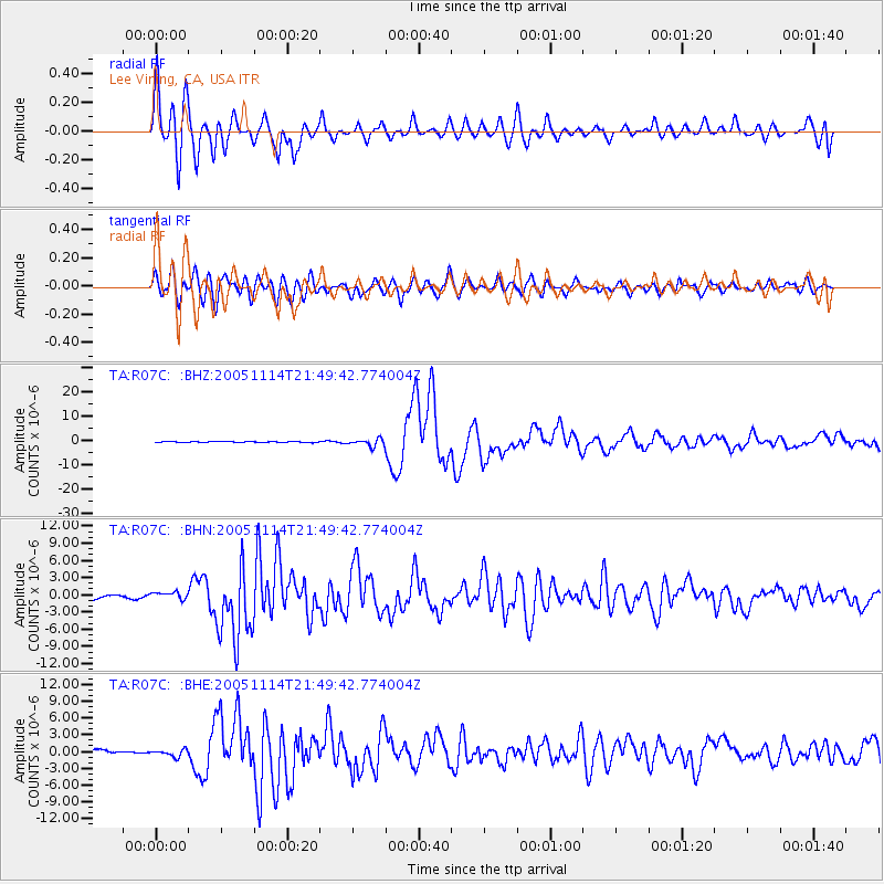
Earthquake location: Off East Coast Of Honshu, Japan
Earthquake latitude/longitude: 38.1/144.9
Earthquake time(UTC): 2005/11/14 (318) 21:38:51 GMT
Earthquake Depth: 11 km
Earthquake Magnitude: 6.7 MB, 6.8 MS, 7.0 MW, 6.9 MW
Earthquake Catalog/Contributor: WHDF/NEIC
Network: TA USArray Transportable Network (new EarthScope stations)
Station: R07C Lee Vining, CA, USA
Lat/Lon: 38.09 N/119.05 W
Elevation: 1996 m
Distance: 71.8 deg
Az: 55.674 deg
Baz: 304.347 deg
Ray Param: 0.054064997
Estimated Moho Depth: 39.75 km
Estimated Crust Vp/Vs: 1.70
Assumed Crust Vp: 6.279 km/s
Estimated Crust Vs: 3.688 km/s
Estimated Crust Poisson's Ratio: 0.24
Radial Match: 93.16504 %
Radial Bump: 400
Transverse Match: 91.121635 %
Transverse Bump: 400
SOD ConfigId: 2448
Insert Time: 2010-03-07 02:35:46.344 +0000
GWidth: 2.5
Max Bumps: 400
Tol: 0.001

Signal To Noise

ChannelStoNSTALTA
TA:R07C: :BHN:20051114T21:49:42.774004Z2.91259776.339258E-72.1764964E-7
TA:R07C: :BHE:20051114T21:49:42.774004Z2.1021256.278924E-72.9869415E-7
TA:R07C: :BHZ:20051114T21:49:42.774004Z10.4694531.4586175E-61.3932127E-7
Arrivals
Ps4.6 SECOND
PpPs17 SECOND
PsPs/PpSs21 SECOND