R07C Lee Vining, CA, USA - Earthquake Result Viewer
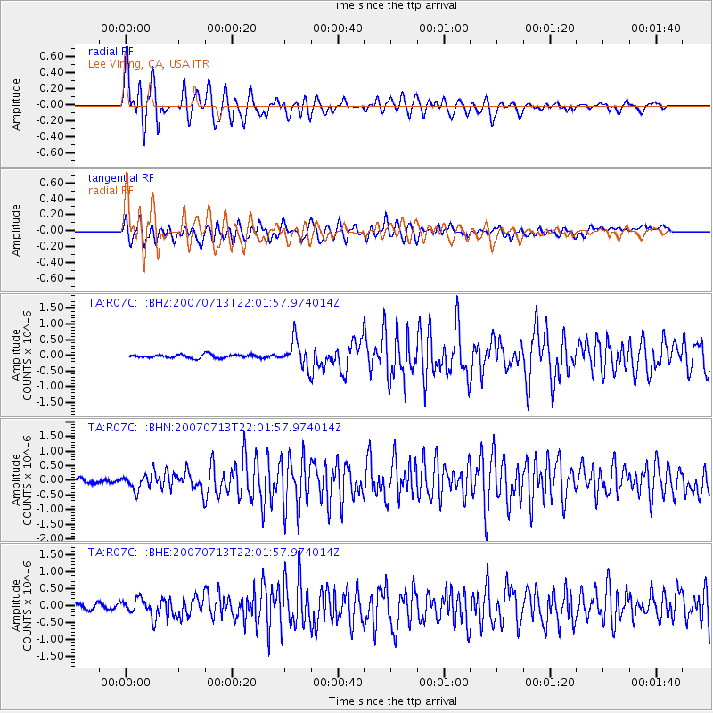
Earthquake location: Andreanof Islands, Aleutian Is.
Earthquake latitude/longitude: 51.8/-176.3
Earthquake time(UTC): 2007/07/13 (194) 21:54:43 GMT
Earthquake Depth: 35 km
Earthquake Magnitude: 5.7 MB, 5.6 MS, 6.0 MW, 5.9 MW
Earthquake Catalog/Contributor: WHDF/NEIC
Network: TA USArray Transportable Network (new EarthScope stations)
Station: R07C Lee Vining, CA, USA
Lat/Lon: 38.09 N/119.05 W
Elevation: 1996 m
Distance: 41.7 deg
Az: 86.014 deg
Baz: 308.333 deg
Ray Param: 0.073557556
Estimated Moho Depth: 36.5 km
Estimated Crust Vp/Vs: 1.79
Assumed Crust Vp: 6.279 km/s
Estimated Crust Vs: 3.508 km/s
Estimated Crust Poisson's Ratio: 0.27
Radial Match: 91.04946 %
Radial Bump: 400
Transverse Match: 84.61029 %
Transverse Bump: 400
SOD ConfigId: 2564
Insert Time: 2010-03-07 02:36:18.550 +0000
GWidth: 2.5
Max Bumps: 400
Tol: 0.001

Signal To Noise

ChannelStoNSTALTA
TA:R07C: :BHN:20070713T22:01:57.974014Z3.76164252.2609093E-76.010431E-8
TA:R07C: :BHE:20070713T22:01:57.974014Z2.24738761.7500575E-77.7870745E-8
TA:R07C: :BHZ:20070713T22:01:57.974014Z7.86611654.2116872E-75.354214E-8
Arrivals
Ps4.9 SECOND
PpPs15 SECOND
PsPs/PpSs20 SECOND