R07C Lee Vining, CA, USA - Earthquake Result Viewer
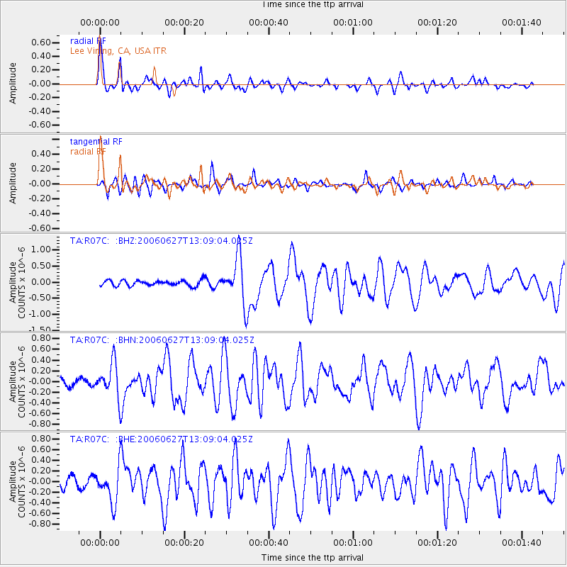
Earthquake location: Off Coast Of Chiapas, Mexico
Earthquake latitude/longitude: 15.0/-94.2
Earthquake time(UTC): 2006/06/27 (178) 13:03:12 GMT
Earthquake Depth: 29 km
Earthquake Magnitude: 5.4 MB, 5.5 MS, 5.8 MW, 5.8 MW
Earthquake Catalog/Contributor: WHDF/NEIC
Network: TA USArray Transportable Network (new EarthScope stations)
Station: R07C Lee Vining, CA, USA
Lat/Lon: 38.09 N/119.05 W
Elevation: 1996 m
Distance: 31.8 deg
Az: 321.025 deg
Baz: 129.605 deg
Ray Param: 0.078866355
Estimated Moho Depth: 25.75 km
Estimated Crust Vp/Vs: 2.10
Assumed Crust Vp: 6.279 km/s
Estimated Crust Vs: 2.997 km/s
Estimated Crust Poisson's Ratio: 0.35
Radial Match: 80.97477 %
Radial Bump: 367
Transverse Match: 81.30886 %
Transverse Bump: 400
SOD ConfigId: 2665
Insert Time: 2010-03-07 02:37:05.450 +0000
GWidth: 2.5
Max Bumps: 400
Tol: 0.001

Signal To Noise

ChannelStoNSTALTA
TA:R07C: :BHN:20060627T13:09:04.025Z5.6458053.2810644E-75.8115088E-8
TA:R07C: :BHE:20060627T13:09:04.025Z4.81773953.4079244E-77.0737E-8
TA:R07C: :BHZ:20060627T13:09:04.025Z8.6364277.3108976E-78.465188E-8
Arrivals
Ps4.8 SECOND
PpPs12 SECOND
PsPs/PpSs17 SECOND