R07C Lee Vining, CA, USA - Earthquake Result Viewer
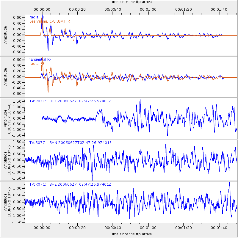
Earthquake location: Rat Islands, Aleutian Islands
Earthquake latitude/longitude: 52.2/176.2
Earthquake time(UTC): 2006/06/27 (178) 02:39:35 GMT
Earthquake Depth: 34 km
Earthquake Magnitude: 5.6 MB, 6.0 MS, 6.2 MW, 6.2 MW
Earthquake Catalog/Contributor: WHDF/NEIC
Network: TA USArray Transportable Network (new EarthScope stations)
Station: R07C Lee Vining, CA, USA
Lat/Lon: 38.09 N/119.05 W
Elevation: 1996 m
Distance: 46.3 deg
Az: 81.008 deg
Baz: 309.616 deg
Ray Param: 0.070680335
Estimated Moho Depth: 39.75 km
Estimated Crust Vp/Vs: 1.63
Assumed Crust Vp: 6.279 km/s
Estimated Crust Vs: 3.846 km/s
Estimated Crust Poisson's Ratio: 0.20
Radial Match: 88.4325 %
Radial Bump: 400
Transverse Match: 74.496666 %
Transverse Bump: 400
SOD ConfigId: 2665
Insert Time: 2010-03-07 02:37:06.890 +0000
GWidth: 2.5
Max Bumps: 400
Tol: 0.001

Signal To Noise

ChannelStoNSTALTA
TA:R07C: :BHN:20060627T02:47:26.97401Z1.80778473.130107E-71.7314599E-7
TA:R07C: :BHE:20060627T02:47:26.97401Z1.48658972.544515E-71.7116457E-7
TA:R07C: :BHZ:20060627T02:47:26.97401Z3.65433454.70291E-71.2869403E-7
Arrivals
Ps4.3 SECOND
PpPs16 SECOND
PsPs/PpSs20 SECOND