
E05A Randle, WA, USA - Earthquake Result Viewer
| ||||||||||||||||||
| ||||||||||||||||||
| ||||||||||||||||||
|
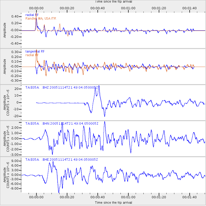
Signal To Noise
| Channel | StoN | STA | LTA |
| TA:E05A: :BHN:20051114T21:49:04.050005Z | 4.438708 | 2.8864144E-7 | 6.502826E-8 |
| TA:E05A: :BHE:20051114T21:49:04.050005Z | 3.1303034 | 8.6354424E-7 | 2.75866E-7 |
| TA:E05A: :BHZ:20051114T21:49:04.050005Z | 12.881832 | 2.722934E-6 | 2.1137785E-7 |
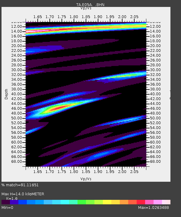
| Arrivals | |
| Ps | 1.3 SECOND |
| PpPs | 5.3 SECOND |
| PsPs/PpSs | 6.6 SECOND |

