
E05A Randle, WA, USA - Earthquake Result Viewer
| ||||||||||||||||||
| ||||||||||||||||||
| ||||||||||||||||||
|
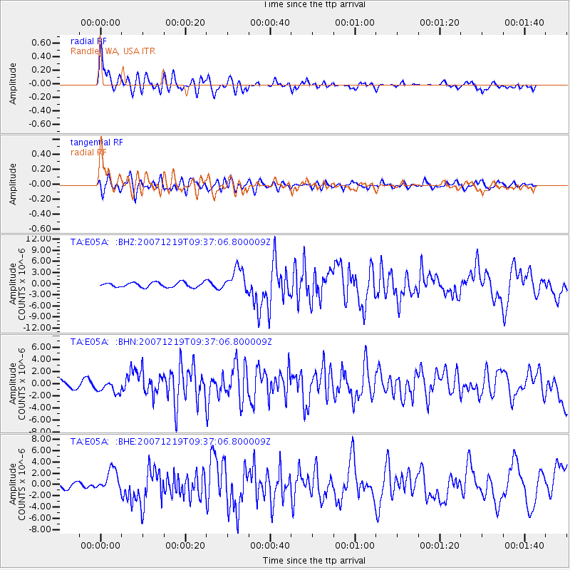
Signal To Noise
| Channel | StoN | STA | LTA |
| TA:E05A: :BHN:20071219T09:37:06.800009Z | 2.2353528 | 1.0765488E-6 | 4.8160126E-7 |
| TA:E05A: :BHE:20071219T09:37:06.800009Z | 2.5444486 | 2.037558E-6 | 8.0078576E-7 |
| TA:E05A: :BHZ:20071219T09:37:06.800009Z | 5.018557 | 3.2639086E-6 | 6.5036795E-7 |
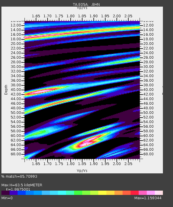
| Arrivals | |
| Ps | 9.0 SECOND |
| PpPs | 26 SECOND |
| PsPs/PpSs | 35 SECOND |

