
E05A Randle, WA, USA - Earthquake Result Viewer
| ||||||||||||||||||
| ||||||||||||||||||
| ||||||||||||||||||
|
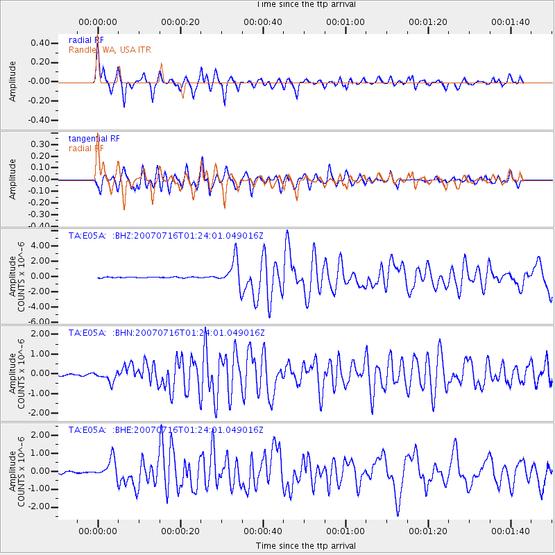
Signal To Noise
| Channel | StoN | STA | LTA |
| TA:E05A: :BHN:20070716T01:24:01.049016Z | 6.3566794 | 2.7858454E-7 | 4.3825484E-8 |
| TA:E05A: :BHE:20070716T01:24:01.049016Z | 8.942968 | 5.492623E-7 | 6.141835E-8 |
| TA:E05A: :BHZ:20070716T01:24:01.049016Z | 34.797894 | 1.8420685E-6 | 5.293621E-8 |
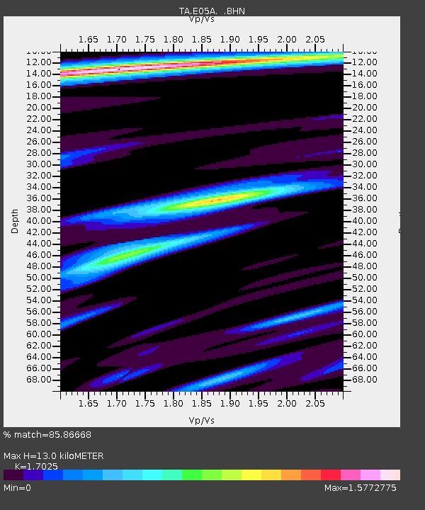
| Arrivals | |
| Ps | 1.4 SECOND |
| PpPs | 5.1 SECOND |
| PsPs/PpSs | 6.6 SECOND |

