
E05A Randle, WA, USA - Earthquake Result Viewer
| ||||||||||||||||||
| ||||||||||||||||||
| ||||||||||||||||||
|
Signal To Noise
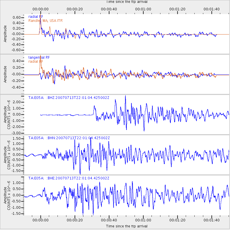
| Channel | StoN | STA | LTA |
| TA:E05A: :BHN:20070713T22:01:04.425002Z | 3.8251061 | 1.7902E-7 | 4.6801315E-8 |
| TA:E05A: :BHE:20070713T22:01:04.425002Z | 6.4244213 | 3.0094273E-7 | 4.6843557E-8 |
| TA:E05A: :BHZ:20070713T22:01:04.425002Z | 17.524372 | 6.519127E-7 | 3.7200348E-8 |
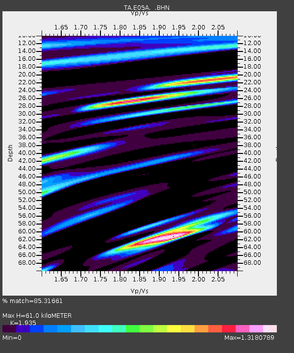
| Arrivals | |
| Ps | 9.3 SECOND |
| PpPs | 25 SECOND |
| PsPs/PpSs | 35 SECOND |

