E05A Randle, WA, USA - Earthquake Result Viewer
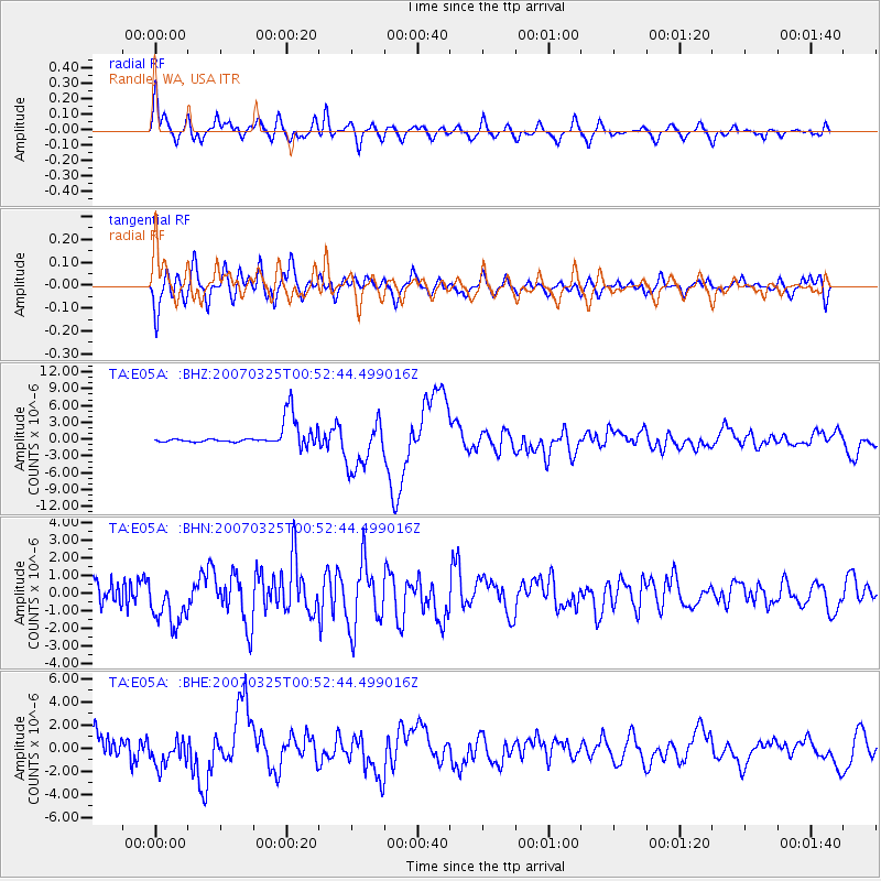
Earthquake location: Near West Coast Of Honshu, Japan
Earthquake latitude/longitude: 37.3/136.6
Earthquake time(UTC): 2007/03/25 (084) 00:41:57 GMT
Earthquake Depth: 8.0 km
Earthquake Magnitude: 6.1 MB, 6.8 MS, 6.7 MW, 6.6 MW
Earthquake Catalog/Contributor: WHDF/NEIC
Network: TA USArray Transportable Network (new EarthScope stations)
Station: E05A Randle, WA, USA
Lat/Lon: 46.56 N/121.76 W
Elevation: 451 m
Distance: 71.0 deg
Az: 45.632 deg
Baz: 304.336 deg
Ray Param: 0.054632805
Estimated Moho Depth: 38.0 km
Estimated Crust Vp/Vs: 1.84
Assumed Crust Vp: 6.597 km/s
Estimated Crust Vs: 3.595 km/s
Estimated Crust Poisson's Ratio: 0.29
Radial Match: 82.713104 %
Radial Bump: 400
Transverse Match: 78.11658 %
Transverse Bump: 400
SOD ConfigId: 2564
Insert Time: 2010-03-07 02:38:26.653 +0000
GWidth: 2.5
Max Bumps: 400
Tol: 0.001

Signal To Noise

ChannelStoNSTALTA
TA:E05A: :BHN:20070325T00:52:44.499016Z3.8947881.37873E-63.5399356E-7
TA:E05A: :BHE:20070325T00:52:44.499016Z2.2380211.2105476E-65.4090094E-7
TA:E05A: :BHZ:20070325T00:52:44.499016Z2.51146774.4962426E-61.7902848E-6
Arrivals
Ps5.0 SECOND
PpPs16 SECOND
PsPs/PpSs21 SECOND