
E05A Randle, WA, USA - Earthquake Result Viewer
| ||||||||||||||||||
| ||||||||||||||||||
| ||||||||||||||||||
|
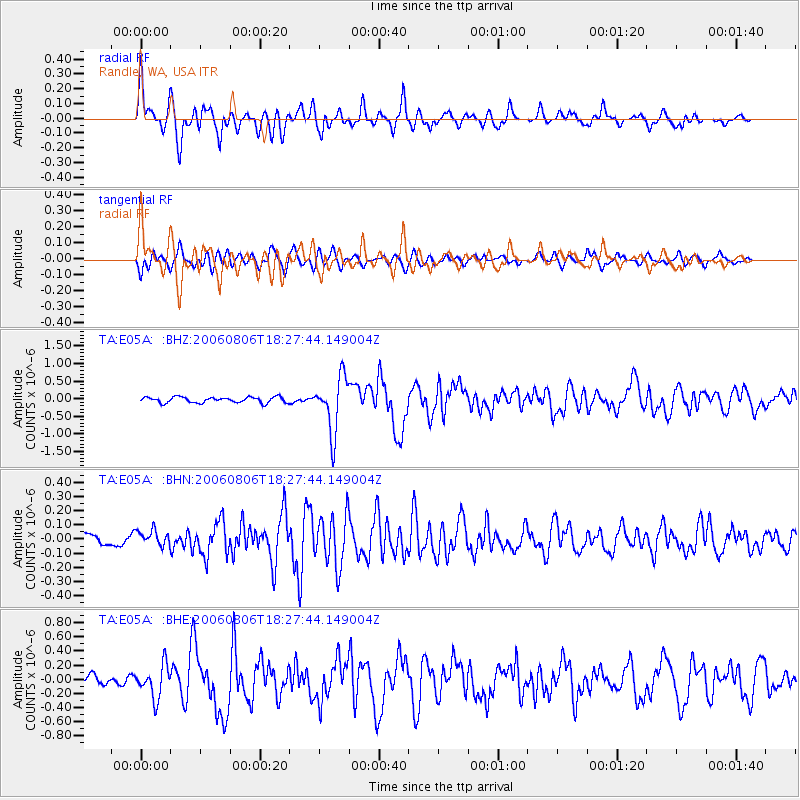
Signal To Noise
| Channel | StoN | STA | LTA |
| TA:E05A: :BHN:20060806T18:27:44.149004Z | 1.231158 | 5.413864E-8 | 4.3973753E-8 |
| TA:E05A: :BHE:20060806T18:27:44.149004Z | 3.0095983 | 2.2614033E-7 | 7.513971E-8 |
| TA:E05A: :BHZ:20060806T18:27:44.149004Z | 9.797381 | 7.841096E-7 | 8.0032564E-8 |
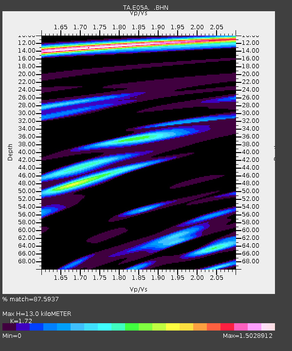
| Arrivals | |
| Ps | 1.5 SECOND |
| PpPs | 5.2 SECOND |
| PsPs/PpSs | 6.6 SECOND |

