
E05A Randle, WA, USA - Earthquake Result Viewer
| ||||||||||||||||||
| ||||||||||||||||||
| ||||||||||||||||||
|
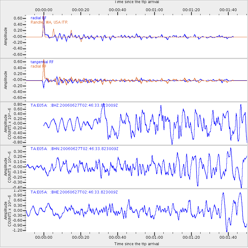
Signal To Noise
| Channel | StoN | STA | LTA |
| TA:E05A: :BHN:20060627T02:46:33.823009Z | 1.7366124 | 8.5750514E-8 | 4.9378038E-8 |
| TA:E05A: :BHE:20060627T02:46:33.823009Z | 1.7498901 | 2.3726628E-7 | 1.3558925E-7 |
| TA:E05A: :BHZ:20060627T02:46:33.823009Z | 2.865105 | 4.560068E-7 | 1.5915886E-7 |
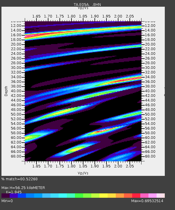
| Arrivals | |
| Ps | 8.6 SECOND |
| PpPs | 23 SECOND |
| PsPs/PpSs | 32 SECOND |

