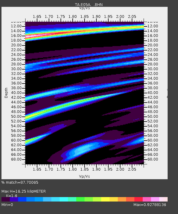
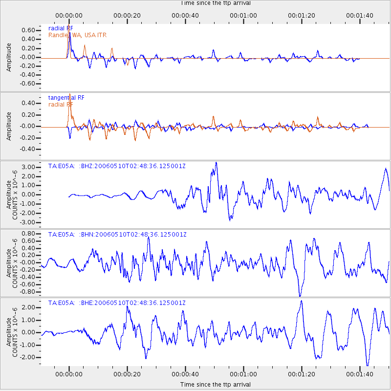
E05A Randle, WA, USA - Earthquake Result Viewer

Earthquake location: Fox Islands, Aleutian Islands
Earthquake latitude/longitude: 52.5/-169.3
Earthquake time(UTC): 2006/05/10 (130) 02:42:51 GMT
Earthquake Depth: 18 km
Earthquake Magnitude: 6.1 MB, 6.2 MS, 6.4 MW, 6.3 MW
Earthquake Catalog/Contributor: WHDF/NEIC
Network: TA USArray Transportable Network (new EarthScope stations)
Station: E05A Randle, WA, USA
Lat/Lon: 46.56 N/121.76 W
Elevation: 451 m
Distance: 30.9 deg
Az: 81.799 deg
Baz: 298.764 deg
Ray Param: 0.07919355
Estimated Moho Depth: 16.25 km
Estimated Crust Vp/Vs: 1.60
Assumed Crust Vp: 6.597 km/s
Estimated Crust Vs: 4.123 km/s
Estimated Crust Poisson's Ratio: 0.18
Radial Match: 87.70065 %
Radial Bump: 308
Transverse Match: 77.55054 %
Transverse Bump: 400
SOD ConfigId: 2669
Insert Time: 2010-03-07 02:39:09.532 +0000
GWidth: 2.5
Max Bumps: 400
Tol: 0.001

Signal To Noise

ChannelStoNSTALTA
TA:E05A: :BHN:20060510T02:48:36.125001Z1.45082071.2935651E-78.916092E-8
TA:E05A: :BHE:20060510T02:48:36.125001Z1.63829281.5541963E-79.486682E-8
TA:E05A: :BHZ:20060510T02:48:36.125001Z2.31250524.152472E-71.7956594E-7
Arrivals
Ps1.6 SECOND
PpPs5.8 SECOND
PsPs/PpSs7.4 SECOND