You are here: Home > Network List > US - United States National Seismic Network Stations List
> Station CBKS Cedar Bluff, Kansas, USA > Earthquake Result Viewer
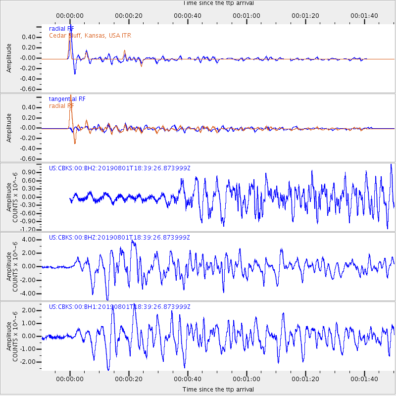
CBKS Cedar Bluff, Kansas, USA - Earthquake Result Viewer

| Earthquake location: |
Near Coast Of Central Chile |
| Earthquake latitude/longitude: |
-34.2/-72.3 |
| Earthquake time(UTC): |
2019/08/01 (213) 18:28:05 GMT |
| Earthquake Depth: |
10 km |
| Earthquake Magnitude: |
6.8 mww |
| Earthquake Catalog/Contributor: |
NEIC PDE/us |
|
| Network: |
US United States National Seismic Network |
| Station: |
CBKS Cedar Bluff, Kansas, USA |
| Lat/Lon: |
38.81 N/99.74 W |
| Elevation: |
677 m |
|
| Distance: |
77.0 deg |
| Az: |
338.307 deg |
| Baz: |
156.922 deg |
| Ray Param: |
0.05060703 |
| Estimated Moho Depth: |
45.25 km |
| Estimated Crust Vp/Vs: |
1.79 |
| Assumed Crust Vp: |
6.483 km/s |
| Estimated Crust Vs: |
3.627 km/s |
| Estimated Crust Poisson's Ratio: |
0.27 |
|
| Radial Match: |
97.63476 % |
| Radial Bump: |
368 |
| Transverse Match: |
88.7834 % |
| Transverse Bump: |
400 |
| SOD ConfigId: |
19053131 |
| Insert Time: |
2019-08-15 18:37:34.850 +0000 |
| GWidth: |
2.5 |
| Max Bumps: |
400 |
| Tol: |
0.001 |
|
Signal To Noise
| Channel | StoN | STA | LTA |
| US:CBKS:00:BHZ:20190801T18:39:26.873999Z | 8.850302 | 5.968596E-7 | 6.743946E-8 |
| US:CBKS:00:BH1:20190801T18:39:26.873999Z | 3.5207028 | 2.8901775E-7 | 8.209092E-8 |
| US:CBKS:00:BH2:20190801T18:39:26.873999Z | 1.5492767 | 1.5077181E-7 | 9.7317546E-8 |
| Arrivals |
| Ps | 5.7 SECOND |
| PpPs | 19 SECOND |
| PsPs/PpSs | 25 SECOND |


