S09A Goldfield, NV, USA - Earthquake Result Viewer
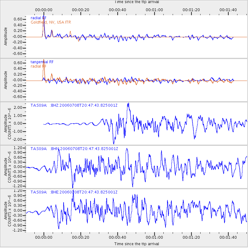
Earthquake location: Andreanof Islands, Aleutian Is.
Earthquake latitude/longitude: 51.2/-179.3
Earthquake time(UTC): 2006/07/08 (189) 20:40:00 GMT
Earthquake Depth: 22 km
Earthquake Magnitude: 6.2 MB, 6.4 MS, 6.6 MW, 6.6 MW
Earthquake Catalog/Contributor: WHDF/NEIC
Network: TA USArray Transportable Network (new EarthScope stations)
Station: S09A Goldfield, NV, USA
Lat/Lon: 37.72 N/117.23 W
Elevation: 1768 m
Distance: 45.0 deg
Az: 82.308 deg
Baz: 308.181 deg
Ray Param: 0.07153662
Estimated Moho Depth: 67.0 km
Estimated Crust Vp/Vs: 2.07
Assumed Crust Vp: 6.279 km/s
Estimated Crust Vs: 3.029 km/s
Estimated Crust Poisson's Ratio: 0.35
Radial Match: 84.34413 %
Radial Bump: 400
Transverse Match: 69.29778 %
Transverse Bump: 400
SOD ConfigId: 2665
Insert Time: 2010-03-07 02:40:13.600 +0000
GWidth: 2.5
Max Bumps: 400
Tol: 0.001

Signal To Noise

ChannelStoNSTALTA
TA:S09A: :BHN:20060708T20:47:43.825001Z3.62029551.7104763E-74.724687E-8
TA:S09A: :BHE:20060708T20:47:43.825001Z1.29117631.3755071E-71.0653131E-7
TA:S09A: :BHZ:20060708T20:47:43.825001Z5.0475323.4843657E-76.903108E-8
Arrivals
Ps12 SECOND
PpPs31 SECOND
PsPs/PpSs43 SECOND