S09A Goldfield, NV, USA - Earthquake Result Viewer
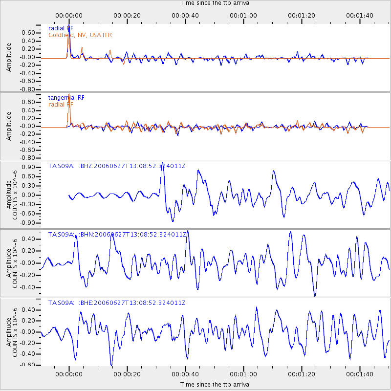
Earthquake location: Off Coast Of Chiapas, Mexico
Earthquake latitude/longitude: 15.0/-94.2
Earthquake time(UTC): 2006/06/27 (178) 13:03:12 GMT
Earthquake Depth: 29 km
Earthquake Magnitude: 5.4 MB, 5.5 MS, 5.8 MW, 5.8 MW
Earthquake Catalog/Contributor: WHDF/NEIC
Network: TA USArray Transportable Network (new EarthScope stations)
Station: S09A Goldfield, NV, USA
Lat/Lon: 37.72 N/117.23 W
Elevation: 1768 m
Distance: 30.5 deg
Az: 322.307 deg
Baz: 131.816 deg
Ray Param: 0.07928834
Estimated Moho Depth: 45.0 km
Estimated Crust Vp/Vs: 1.99
Assumed Crust Vp: 6.279 km/s
Estimated Crust Vs: 3.155 km/s
Estimated Crust Poisson's Ratio: 0.33
Radial Match: 82.182274 %
Radial Bump: 276
Transverse Match: 66.464645 %
Transverse Bump: 400
SOD ConfigId: 2665
Insert Time: 2010-03-07 02:40:18.502 +0000
GWidth: 2.5
Max Bumps: 400
Tol: 0.001

Signal To Noise

ChannelStoNSTALTA
TA:S09A: :BHN:20060627T13:08:52.324011Z5.7652262.1440319E-73.7189036E-8
TA:S09A: :BHE:20060627T13:08:52.324011Z6.1957332.5439425E-74.105959E-8
TA:S09A: :BHZ:20060627T13:08:52.324011Z6.8195684.980117E-77.302686E-8
Arrivals
Ps7.6 SECOND
PpPs20 SECOND
PsPs/PpSs28 SECOND