S09A Goldfield, NV, USA - Earthquake Result Viewer
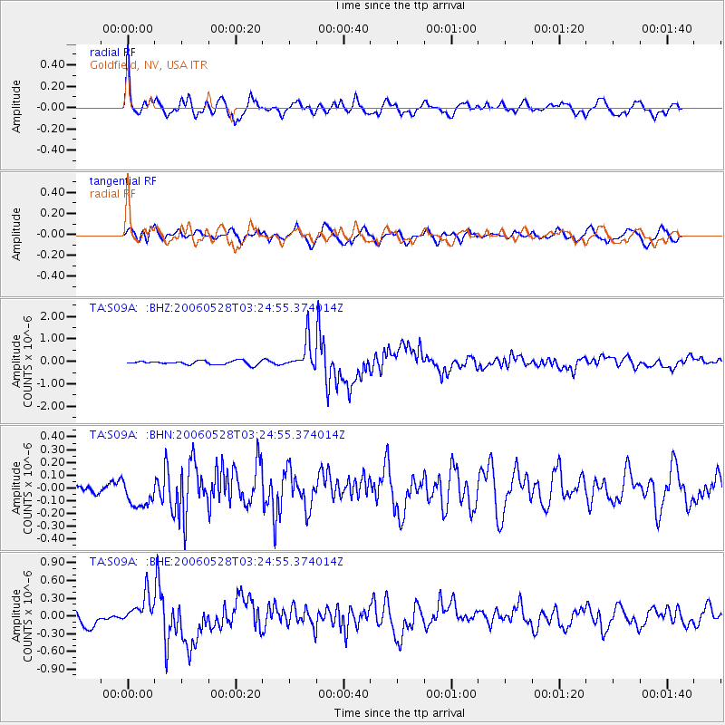
Earthquake location: New Britain Region, P.N.G.
Earthquake latitude/longitude: -5.7/151.1
Earthquake time(UTC): 2006/05/28 (148) 03:12:08 GMT
Earthquake Depth: 34 km
Earthquake Magnitude: 5.9 MB, 6.6 MS, 6.5 MW, 6.4 MW
Earthquake Catalog/Contributor: WHDF/NEIC
Network: TA USArray Transportable Network (new EarthScope stations)
Station: S09A Goldfield, NV, USA
Lat/Lon: 37.72 N/117.23 W
Elevation: 1768 m
Distance: 94.8 deg
Az: 52.69 deg
Baz: 266.479 deg
Ray Param: 0.04094744
Estimated Moho Depth: 30.75 km
Estimated Crust Vp/Vs: 2.06
Assumed Crust Vp: 6.279 km/s
Estimated Crust Vs: 3.052 km/s
Estimated Crust Poisson's Ratio: 0.35
Radial Match: 83.644455 %
Radial Bump: 400
Transverse Match: 58.354187 %
Transverse Bump: 400
SOD ConfigId: 2669
Insert Time: 2010-03-07 02:40:30.416 +0000
GWidth: 2.5
Max Bumps: 400
Tol: 0.001

Signal To Noise

ChannelStoNSTALTA
TA:S09A: :BHN:20060528T03:24:55.374014Z1.28489411.2113588E-79.4276935E-8
TA:S09A: :BHE:20060528T03:24:55.374014Z2.00529842.4718608E-71.2326647E-7
TA:S09A: :BHZ:20060528T03:24:55.374014Z7.8962886.6796713E-78.459255E-8
Arrivals
Ps5.3 SECOND
PpPs15 SECOND
PsPs/PpSs20 SECOND