S09A Goldfield, NV, USA - Earthquake Result Viewer
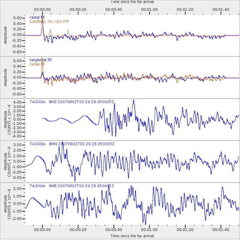
Earthquake location: Andreanof Islands, Aleutian Is.
Earthquake latitude/longitude: 51.3/-180.0
Earthquake time(UTC): 2007/08/02 (214) 03:21:42 GMT
Earthquake Depth: 21 km
Earthquake Magnitude: 6.3 MB, 6.6 MS, 6.7 MW, 6.6 MW
Earthquake Catalog/Contributor: WHDF/NEIC
Network: TA USArray Transportable Network (new EarthScope stations)
Station: S09A Goldfield, NV, USA
Lat/Lon: 37.72 N/117.23 W
Elevation: 1768 m
Distance: 45.4 deg
Az: 81.944 deg
Baz: 308.391 deg
Ray Param: 0.07127758
Estimated Moho Depth: 28.75 km
Estimated Crust Vp/Vs: 1.95
Assumed Crust Vp: 6.279 km/s
Estimated Crust Vs: 3.228 km/s
Estimated Crust Poisson's Ratio: 0.32
Radial Match: 81.30578 %
Radial Bump: 400
Transverse Match: 68.14509 %
Transverse Bump: 400
SOD ConfigId: 2564
Insert Time: 2010-03-07 02:41:01.754 +0000
GWidth: 2.5
Max Bumps: 400
Tol: 0.001

Signal To Noise

ChannelStoNSTALTA
TA:S09A: :BHN:20070802T03:29:28.950005Z2.83106181.2319865E-64.3516766E-7
TA:S09A: :BHE:20070802T03:29:28.950005Z0.445603552.8651917E-76.429912E-7
TA:S09A: :BHZ:20070802T03:29:28.950005Z2.77476221.2604988E-64.5427274E-7
Arrivals
Ps4.6 SECOND
PpPs13 SECOND
PsPs/PpSs17 SECOND