S09A Goldfield, NV, USA - Earthquake Result Viewer
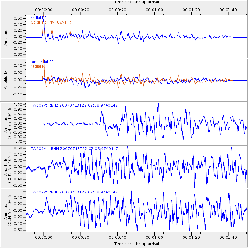
Earthquake location: Andreanof Islands, Aleutian Is.
Earthquake latitude/longitude: 51.8/-176.3
Earthquake time(UTC): 2007/07/13 (194) 21:54:43 GMT
Earthquake Depth: 35 km
Earthquake Magnitude: 5.7 MB, 5.6 MS, 6.0 MW, 5.9 MW
Earthquake Catalog/Contributor: WHDF/NEIC
Network: TA USArray Transportable Network (new EarthScope stations)
Station: S09A Goldfield, NV, USA
Lat/Lon: 37.72 N/117.23 W
Elevation: 1768 m
Distance: 43.0 deg
Az: 85.104 deg
Baz: 308.775 deg
Ray Param: 0.07273137
Estimated Moho Depth: 56.25 km
Estimated Crust Vp/Vs: 1.95
Assumed Crust Vp: 6.279 km/s
Estimated Crust Vs: 3.228 km/s
Estimated Crust Poisson's Ratio: 0.32
Radial Match: 86.945274 %
Radial Bump: 400
Transverse Match: 74.8584 %
Transverse Bump: 400
SOD ConfigId: 2564
Insert Time: 2010-03-07 02:41:18.928 +0000
GWidth: 2.5
Max Bumps: 400
Tol: 0.001

Signal To Noise

ChannelStoNSTALTA
TA:S09A: :BHN:20070713T22:02:08.974014Z2.82413431.6239166E-75.7501396E-8
TA:S09A: :BHE:20070713T22:02:08.974014Z2.89693161.99577E-76.8892554E-8
TA:S09A: :BHZ:20070713T22:02:08.974014Z8.8617764.1804773E-74.717426E-8
Arrivals
Ps9.0 SECOND
PpPs25 SECOND
PsPs/PpSs34 SECOND