You are here: Home > Network List > TA - USArray Transportable Network (new EarthScope stations) Stations List
> Station C16K Lisburne Hills, AK, USA > Earthquake Result Viewer
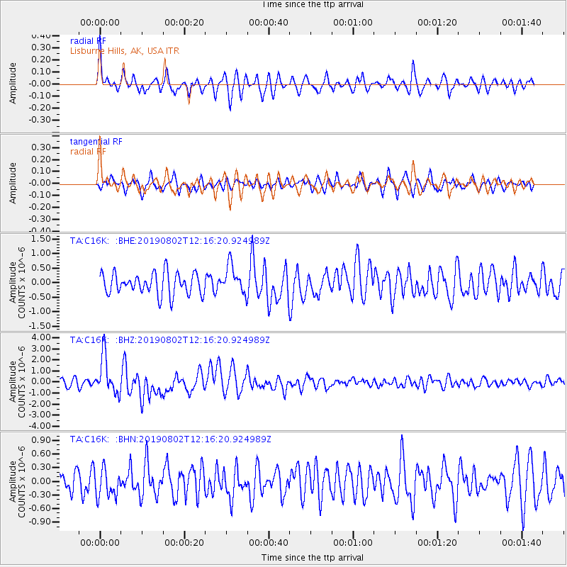
C16K Lisburne Hills, AK, USA - Earthquake Result Viewer
*The percent match for this event was below the threshold and hence no stack was calculated.
| Earthquake location: |
Southwest Of Sumatra, Indonesia |
| Earthquake latitude/longitude: |
-7.3/104.8 |
| Earthquake time(UTC): |
2019/08/02 (214) 12:03:26 GMT |
| Earthquake Depth: |
43 km |
| Earthquake Magnitude: |
6.8 Mww |
| Earthquake Catalog/Contributor: |
NEIC PDE/us |
|
| Network: |
TA USArray Transportable Network (new EarthScope stations) |
| Station: |
C16K Lisburne Hills, AK, USA |
| Lat/Lon: |
68.27 N/165.34 W |
| Elevation: |
102 m |
|
| Distance: |
96.7 deg |
| Az: |
22.014 deg |
| Baz: |
267.153 deg |
| Ray Param: |
$rayparam |
*The percent match for this event was below the threshold and hence was not used in the summary stack. |
|
| Radial Match: |
73.16763 % |
| Radial Bump: |
400 |
| Transverse Match: |
65.61539 % |
| Transverse Bump: |
400 |
| SOD ConfigId: |
19053131 |
| Insert Time: |
2019-08-16 12:07:45.675 +0000 |
| GWidth: |
2.5 |
| Max Bumps: |
400 |
| Tol: |
0.001 |
|
Signal To Noise
| Channel | StoN | STA | LTA |
| TA:C16K: :BHZ:20190802T12:16:20.924989Z | 6.466422 | 1.7303904E-6 | 2.6759628E-7 |
| TA:C16K: :BHN:20190802T12:16:20.924989Z | 1.0661632 | 3.053785E-7 | 2.8642756E-7 |
| TA:C16K: :BHE:20190802T12:16:20.924989Z | 1.3689243 | 5.048694E-7 | 3.6880738E-7 |
| Arrivals |
| Ps | |
| PpPs | |
| PsPs/PpSs | |


