
L08A Fields, OR, USA - Earthquake Result Viewer
| ||||||||||||||||||
| ||||||||||||||||||
| ||||||||||||||||||
|
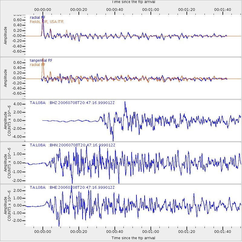
Signal To Noise
| Channel | StoN | STA | LTA |
| TA:L08A: :BHN:20060708T20:47:16.999012Z | 1.9000871 | 1.6449445E-7 | 8.657206E-8 |
| TA:L08A: :BHE:20060708T20:47:16.999012Z | 3.5000064 | 3.333618E-7 | 9.524606E-8 |
| TA:L08A: :BHZ:20060708T20:47:16.999012Z | 5.811272 | 6.563697E-7 | 1.1294768E-7 |
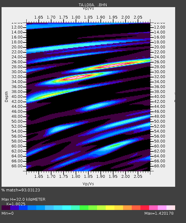
| Arrivals | |
| Ps | 4.4 SECOND |
| PpPs | 13 SECOND |
| PsPs/PpSs | 18 SECOND |

