
L08A Fields, OR, USA - Earthquake Result Viewer
| ||||||||||||||||||
| ||||||||||||||||||
| ||||||||||||||||||
|
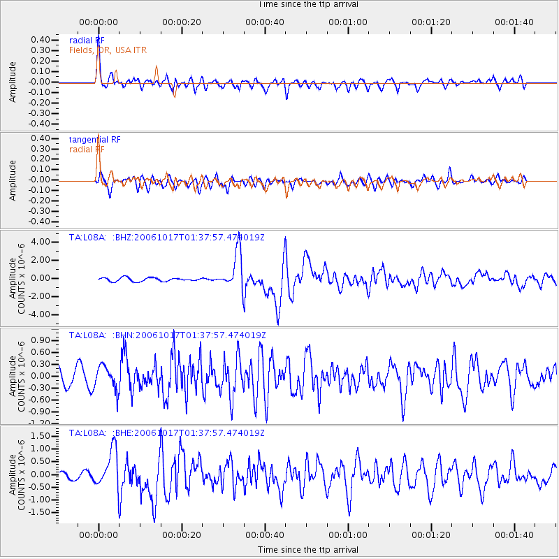
Signal To Noise
| Channel | StoN | STA | LTA |
| TA:L08A: :BHN:20061017T01:37:57.474019Z | 1.4091276 | 3.0035045E-7 | 2.1314638E-7 |
| TA:L08A: :BHE:20061017T01:37:57.474019Z | 3.8266854 | 7.877009E-7 | 2.0584417E-7 |
| TA:L08A: :BHZ:20061017T01:37:57.474019Z | 11.006096 | 2.1619064E-6 | 1.9642809E-7 |
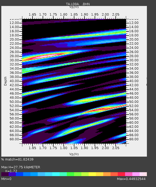
| Arrivals | |
| Ps | 3.2 SECOND |
| PpPs | 12 SECOND |
| PsPs/PpSs | 15 SECOND |

