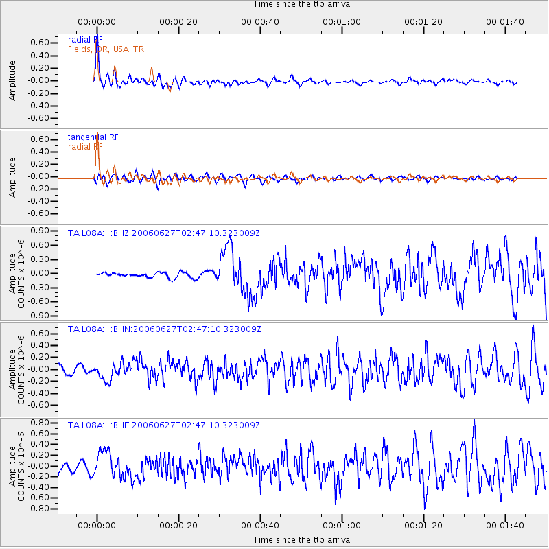
L08A Fields, OR, USA - Earthquake Result Viewer
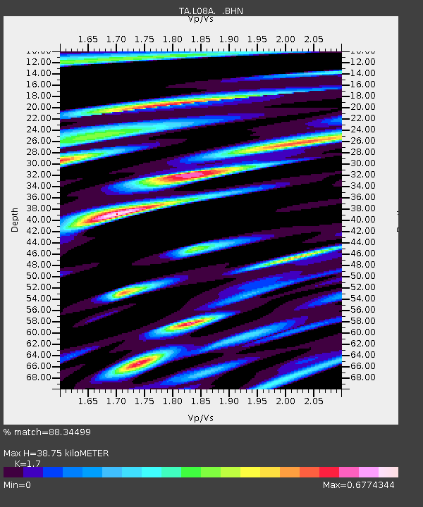
Earthquake location: Rat Islands, Aleutian Islands
Earthquake latitude/longitude: 52.2/176.2
Earthquake time(UTC): 2006/06/27 (178) 02:39:35 GMT
Earthquake Depth: 34 km
Earthquake Magnitude: 5.6 MB, 6.0 MS, 6.2 MW, 6.2 MW
Earthquake Catalog/Contributor: WHDF/NEIC
Network: TA USArray Transportable Network (new EarthScope stations)
Station: L08A Fields, OR, USA
Lat/Lon: 42.19 N/118.34 W
Elevation: 1490 m
Distance: 44.2 deg
Az: 75.997 deg
Baz: 306.536 deg
Ray Param: 0.072014846
Estimated Moho Depth: 38.75 km
Estimated Crust Vp/Vs: 1.70
Assumed Crust Vp: 6.279 km/s
Estimated Crust Vs: 3.693 km/s
Estimated Crust Poisson's Ratio: 0.24
Radial Match: 88.34499 %
Radial Bump: 369
Transverse Match: 71.803696 %
Transverse Bump: 400
SOD ConfigId: 2665
Insert Time: 2010-03-07 02:46:08.824 +0000
GWidth: 2.5
Max Bumps: 400
Tol: 0.001

Signal To Noise

ChannelStoNSTALTA
TA:L08A: :BHN:20060627T02:47:10.323009Z1.81098741.407418E-77.7715505E-8
TA:L08A: :BHE:20060627T02:47:10.323009Z2.95352132.5343465E-78.580762E-8
TA:L08A: :BHZ:20060627T02:47:10.323009Z8.545934.5874577E-75.3680033E-8
Arrivals
Ps4.6 SECOND
PpPs16 SECOND
PsPs/PpSs20 SECOND