
L08A Fields, OR, USA - Earthquake Result Viewer
| ||||||||||||||||||
| ||||||||||||||||||
| ||||||||||||||||||
|
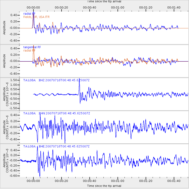
Signal To Noise
| Channel | StoN | STA | LTA |
| TA:L08A: :BHN:20070716T06:48:45.625007Z | 3.783192 | 1.751061E-7 | 4.628528E-8 |
| TA:L08A: :BHE:20070716T06:48:45.625007Z | 5.1988273 | 2.502632E-7 | 4.8138396E-8 |
| TA:L08A: :BHZ:20070716T06:48:45.625007Z | 9.261248 | 5.158137E-7 | 5.5695924E-8 |
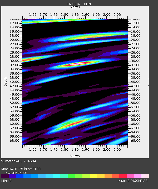
| Arrivals | |
| Ps | 4.4 SECOND |
| PpPs | 14 SECOND |
| PsPs/PpSs | 18 SECOND |

