
L08A Fields, OR, USA - Earthquake Result Viewer
| ||||||||||||||||||
| ||||||||||||||||||
| ||||||||||||||||||
|
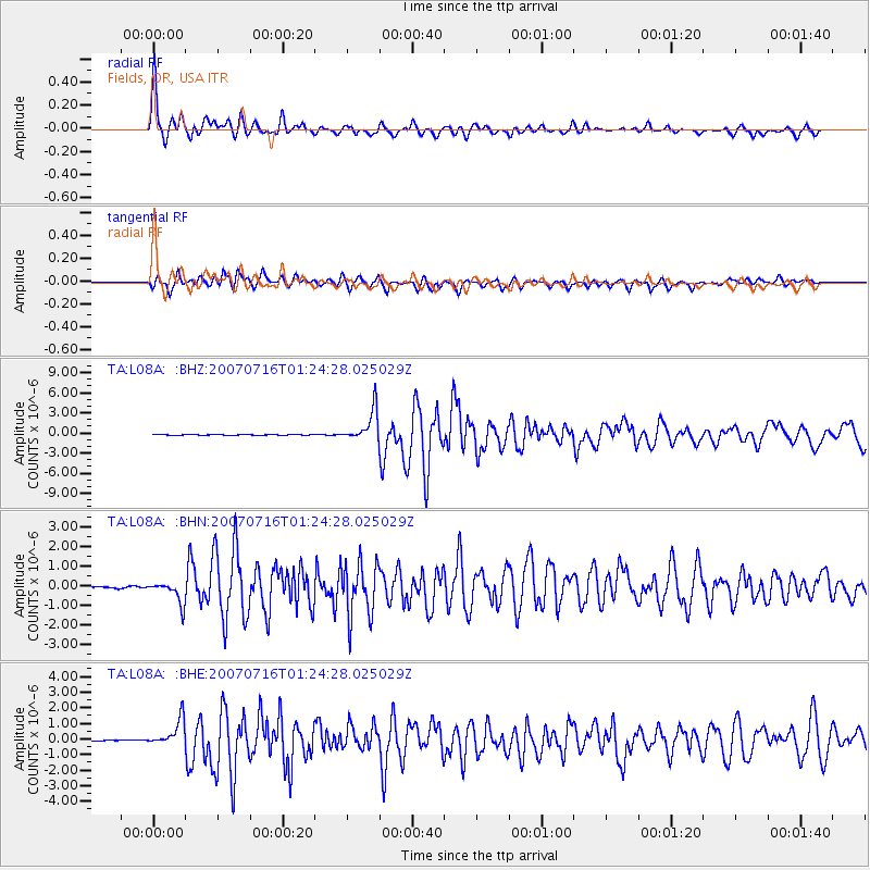
Signal To Noise
| Channel | StoN | STA | LTA |
| TA:L08A: :BHN:20070716T01:24:28.025029Z | 12.7254715 | 5.622428E-7 | 4.418247E-8 |
| TA:L08A: :BHE:20070716T01:24:28.025029Z | 12.823113 | 8.742216E-7 | 6.817546E-8 |
| TA:L08A: :BHZ:20070716T01:24:28.025029Z | 37.631947 | 2.3269806E-6 | 6.1835244E-8 |
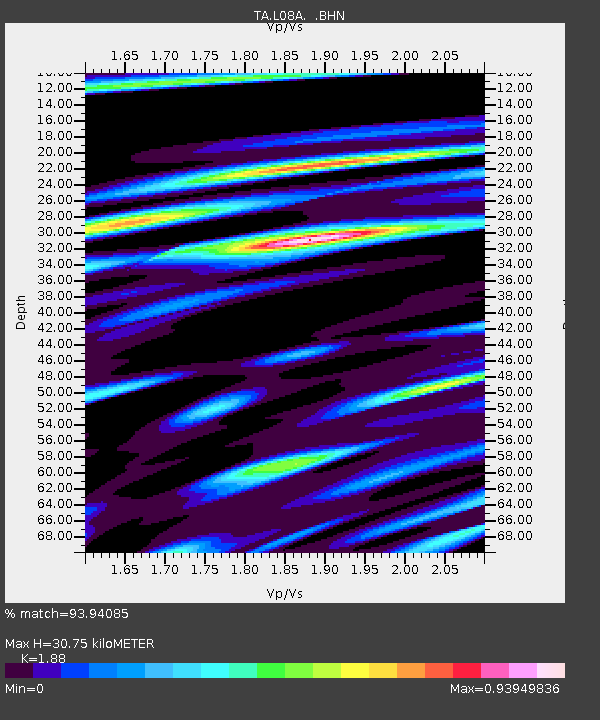
| Arrivals | |
| Ps | 4.4 SECOND |
| PpPs | 14 SECOND |
| PsPs/PpSs | 18 SECOND |

