
L08A Fields, OR, USA - Earthquake Result Viewer
| ||||||||||||||||||
| ||||||||||||||||||
| ||||||||||||||||||
|
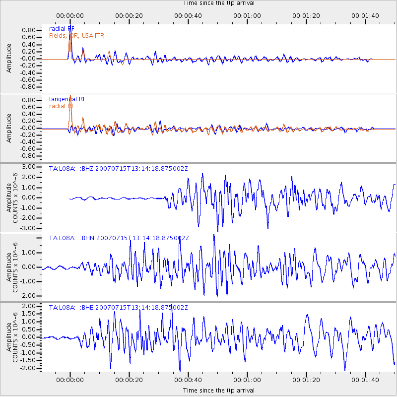
Signal To Noise
| Channel | StoN | STA | LTA |
| TA:L08A: :BHN:20070715T13:14:18.875002Z | 2.6036026 | 1.3108104E-7 | 5.0346024E-8 |
| TA:L08A: :BHE:20070715T13:14:18.875002Z | 6.138959 | 1.9012417E-7 | 3.09701E-8 |
| TA:L08A: :BHZ:20070715T13:14:18.875002Z | 5.0379806 | 3.6530537E-7 | 7.251028E-8 |
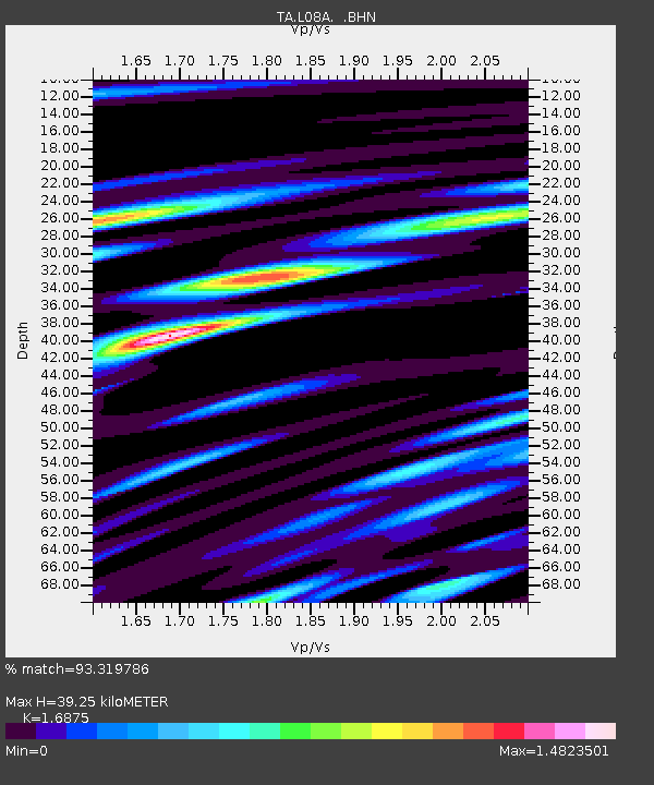
| Arrivals | |
| Ps | 4.6 SECOND |
| PpPs | 16 SECOND |
| PsPs/PpSs | 20 SECOND |

