L08A Fields, OR, USA - Earthquake Result Viewer
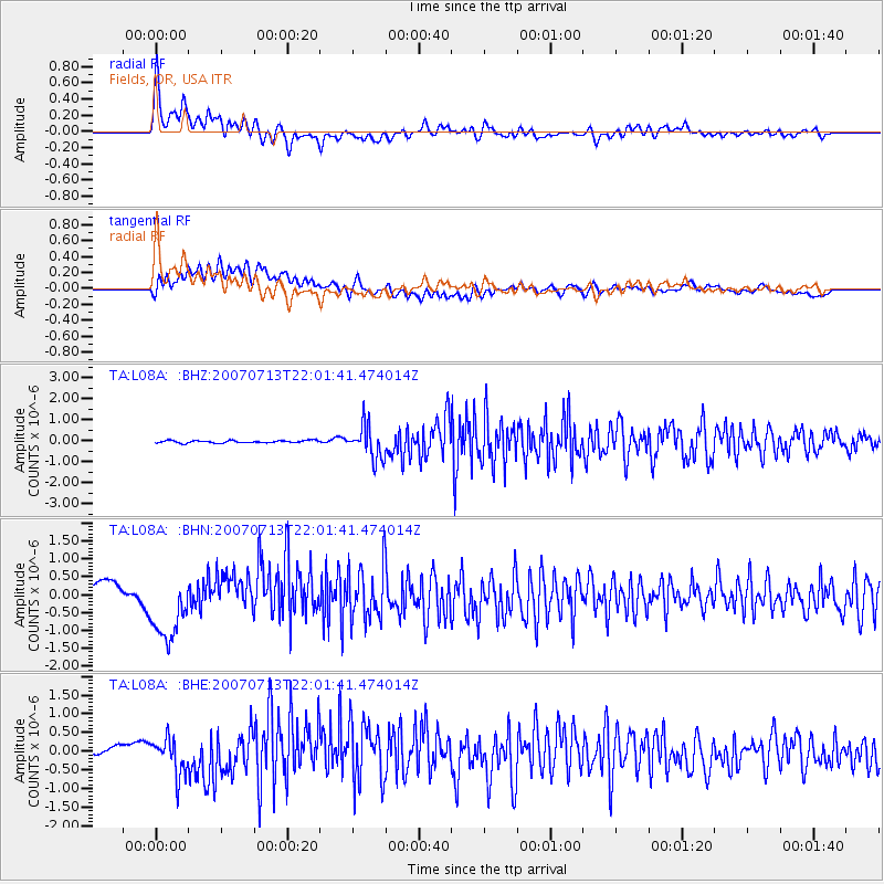
Earthquake location: Andreanof Islands, Aleutian Is.
Earthquake latitude/longitude: 51.8/-176.3
Earthquake time(UTC): 2007/07/13 (194) 21:54:43 GMT
Earthquake Depth: 35 km
Earthquake Magnitude: 5.7 MB, 5.6 MS, 6.0 MW, 5.9 MW
Earthquake Catalog/Contributor: WHDF/NEIC
Network: TA USArray Transportable Network (new EarthScope stations)
Station: L08A Fields, OR, USA
Lat/Lon: 42.19 N/118.34 W
Elevation: 1490 m
Distance: 39.7 deg
Az: 80.468 deg
Baz: 304.578 deg
Ray Param: 0.074768804
Estimated Moho Depth: 32.75 km
Estimated Crust Vp/Vs: 1.79
Assumed Crust Vp: 6.279 km/s
Estimated Crust Vs: 3.508 km/s
Estimated Crust Poisson's Ratio: 0.27
Radial Match: 85.40092 %
Radial Bump: 400
Transverse Match: 55.450645 %
Transverse Bump: 400
SOD ConfigId: 2564
Insert Time: 2010-03-07 02:46:37.412 +0000
GWidth: 2.5
Max Bumps: 400
Tol: 0.001

Signal To Noise

ChannelStoNSTALTA
TA:L08A: :BHN:20070713T22:01:41.474014Z3.16886289.1677134E-72.8930612E-7
TA:L08A: :BHE:20070713T22:01:41.474014Z3.12390524.855824E-71.5544083E-7
TA:L08A: :BHZ:20070713T22:01:41.474014Z13.9174887.947156E-75.7101943E-8
Arrivals
Ps4.4 SECOND
PpPs14 SECOND
PsPs/PpSs18 SECOND