
L08A Fields, OR, USA - Earthquake Result Viewer
| ||||||||||||||||||
| ||||||||||||||||||
| ||||||||||||||||||
|
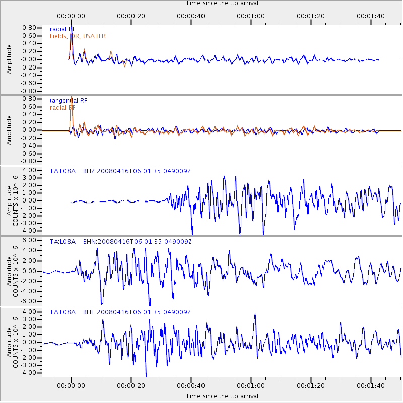
Signal To Noise
| Channel | StoN | STA | LTA |
| TA:L08A: :BHN:20080416T06:01:35.049009Z | 4.2056966 | 7.981796E-7 | 1.8978535E-7 |
| TA:L08A: :BHE:20080416T06:01:35.049009Z | 1.4986591 | 2.539627E-7 | 1.6945995E-7 |
| TA:L08A: :BHZ:20080416T06:01:35.049009Z | 4.5593433 | 4.3535027E-7 | 9.54853E-8 |
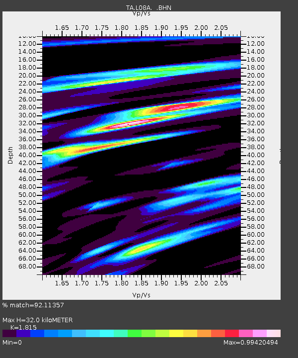
| Arrivals | |
| Ps | 4.4 SECOND |
| PpPs | 13 SECOND |
| PsPs/PpSs | 18 SECOND |

