You are here: Home > Network List > TA - USArray Transportable Network (new EarthScope stations) Stations List
> Station L08A Fields, OR, USA > Earthquake Result Viewer
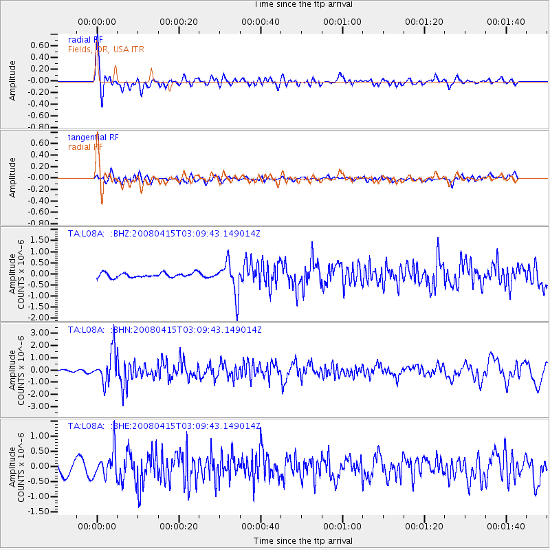
L08A Fields, OR, USA - Earthquake Result Viewer
*The percent match for this event was below the threshold and hence no stack was calculated.
| Earthquake location: |
Near Coast Of Guatemala |
| Earthquake latitude/longitude: |
13.6/-90.6 |
| Earthquake time(UTC): |
2008/04/15 (106) 03:03:04 GMT |
| Earthquake Depth: |
33 km |
| Earthquake Magnitude: |
5.6 MB, 5.8 MS, 6.1 MW, 6.1 MW |
| Earthquake Catalog/Contributor: |
WHDF/NEIC |
|
| Network: |
TA USArray Transportable Network (new EarthScope stations) |
| Station: |
L08A Fields, OR, USA |
| Lat/Lon: |
42.19 N/118.34 W |
| Elevation: |
1490 m |
|
| Distance: |
37.3 deg |
| Az: |
325.179 deg |
| Baz: |
131.652 deg |
| Ray Param: |
$rayparam |
*The percent match for this event was below the threshold and hence was not used in the summary stack. |
|
| Radial Match: |
72.662 % |
| Radial Bump: |
400 |
| Transverse Match: |
52.28926 % |
| Transverse Bump: |
400 |
| SOD ConfigId: |
2504 |
| Insert Time: |
2010-03-07 02:47:03.058 +0000 |
| GWidth: |
2.5 |
| Max Bumps: |
400 |
| Tol: |
0.001 |
|
Signal To Noise
| Channel | StoN | STA | LTA |
| TA:L08A: :BHN:20080415T03:09:43.149014Z | 9.427612 | 1.3473683E-6 | 1.4291723E-7 |
| TA:L08A: :BHE:20080415T03:09:43.149014Z | 1.3034843 | 4.512557E-7 | 3.4619188E-7 |
| TA:L08A: :BHZ:20080415T03:09:43.149014Z | 7.2521825 | 7.4154707E-7 | 1.02251576E-7 |
| Arrivals |
| Ps | |
| PpPs | |
| PsPs/PpSs | |


