You are here: Home > Network List > TA - USArray Transportable Network (new EarthScope stations) Stations List
> Station I17K Unalakleet, AK, USA > Earthquake Result Viewer
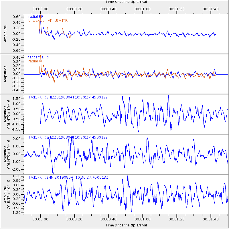
I17K Unalakleet, AK, USA - Earthquake Result Viewer
*The percent match for this event was below the threshold and hence no stack was calculated.
| Earthquake location: |
Near East Coast Of Honshu, Japan |
| Earthquake latitude/longitude: |
37.7/141.5 |
| Earthquake time(UTC): |
2019/08/04 (216) 10:23:03 GMT |
| Earthquake Depth: |
39 km |
| Earthquake Magnitude: |
6.3 Mww |
| Earthquake Catalog/Contributor: |
NEIC PDE/us |
|
| Network: |
TA USArray Transportable Network (new EarthScope stations) |
| Station: |
I17K Unalakleet, AK, USA |
| Lat/Lon: |
63.89 N/160.70 W |
| Elevation: |
105 m |
|
| Distance: |
42.8 deg |
| Az: |
33.427 deg |
| Baz: |
260.728 deg |
| Ray Param: |
$rayparam |
*The percent match for this event was below the threshold and hence was not used in the summary stack. |
|
| Radial Match: |
52.450027 % |
| Radial Bump: |
359 |
| Transverse Match: |
44.98545 % |
| Transverse Bump: |
400 |
| SOD ConfigId: |
19053131 |
| Insert Time: |
2019-08-18 10:34:28.526 +0000 |
| GWidth: |
2.5 |
| Max Bumps: |
400 |
| Tol: |
0.001 |
|
Signal To Noise
| Channel | StoN | STA | LTA |
| TA:I17K: :BHZ:20190804T10:30:27.450013Z | 2.711433 | 7.405748E-7 | 2.731304E-7 |
| TA:I17K: :BHN:20190804T10:30:27.450013Z | 0.60738426 | 2.2406175E-7 | 3.688962E-7 |
| TA:I17K: :BHE:20190804T10:30:27.450013Z | 0.58937305 | 2.6794982E-7 | 4.546353E-7 |
| Arrivals |
| Ps | |
| PpPs | |
| PsPs/PpSs | |


