
L07A Adel, OR, USA - Earthquake Result Viewer
| ||||||||||||||||||
| ||||||||||||||||||
| ||||||||||||||||||
|
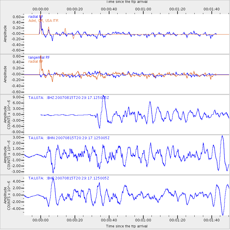
Signal To Noise
| Channel | StoN | STA | LTA |
| TA:L07A: :BHN:20070815T20:29:17.125005Z | 2.6982362 | 4.964914E-7 | 1.8400591E-7 |
| TA:L07A: :BHE:20070815T20:29:17.125005Z | 4.0009813 | 1.2081114E-6 | 3.0195375E-7 |
| TA:L07A: :BHZ:20070815T20:29:17.125005Z | 18.576223 | 2.5684242E-6 | 1.3826406E-7 |
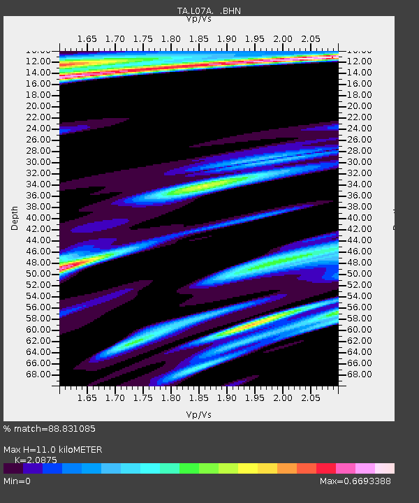
| Arrivals | |
| Ps | 2.0 SECOND |
| PpPs | 5.1 SECOND |
| PsPs/PpSs | 7.1 SECOND |

