
L07A Adel, OR, USA - Earthquake Result Viewer
| ||||||||||||||||||
| ||||||||||||||||||
| ||||||||||||||||||
|
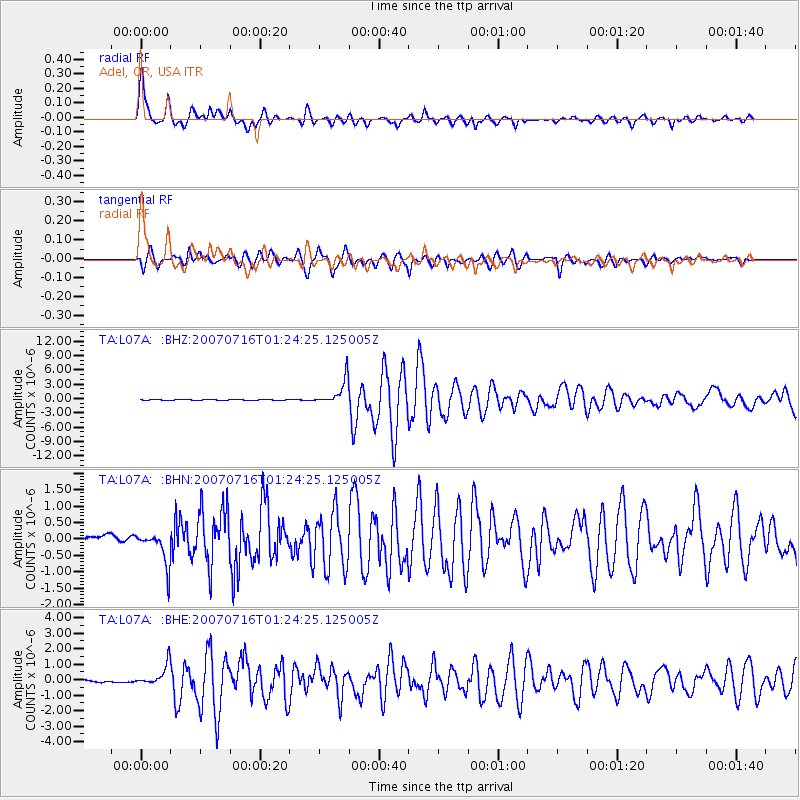
Signal To Noise
| Channel | StoN | STA | LTA |
| TA:L07A: :BHN:20070716T01:24:25.125005Z | 5.4873614 | 5.106019E-7 | 9.305054E-8 |
| TA:L07A: :BHE:20070716T01:24:25.125005Z | 11.604232 | 6.620776E-7 | 5.705484E-8 |
| TA:L07A: :BHZ:20070716T01:24:25.125005Z | 30.80276 | 2.6207042E-6 | 8.5080174E-8 |
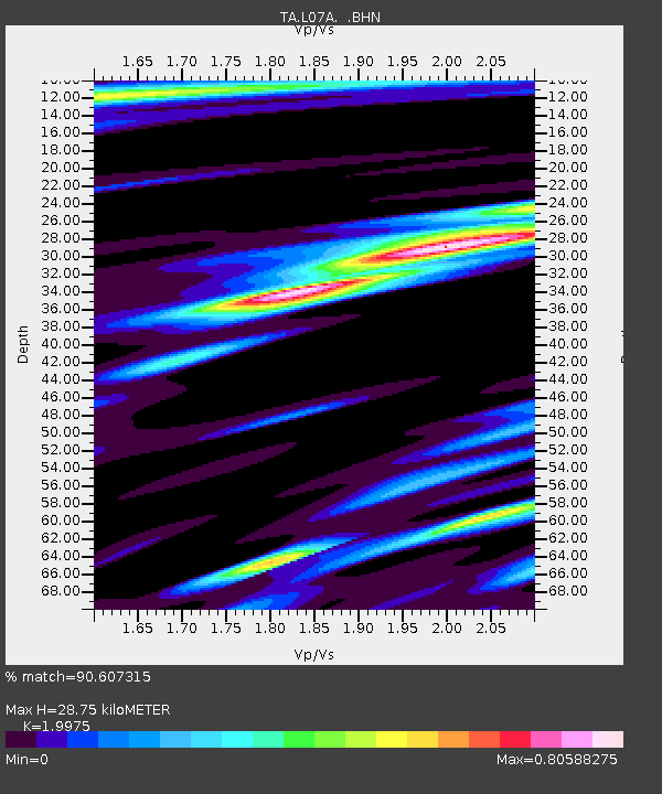
| Arrivals | |
| Ps | 4.7 SECOND |
| PpPs | 13 SECOND |
| PsPs/PpSs | 18 SECOND |

