You are here: Home > Network List > UU - University of Utah Regional Network Stations List
> Station KNB Kanab, UT, USA > Earthquake Result Viewer
KNB Kanab, UT, USA - Earthquake Result Viewer

| Earthquake location: |
Near East Coast Of Honshu, Japan |
| Earthquake latitude/longitude: |
37.7/141.5 |
| Earthquake time(UTC): |
2019/08/04 (216) 10:23:03 GMT |
| Earthquake Depth: |
39 km |
| Earthquake Magnitude: |
6.3 Mww |
| Earthquake Catalog/Contributor: |
NEIC PDE/us |
|
| Network: |
UU University of Utah Regional Network |
| Station: |
KNB Kanab, UT, USA |
| Lat/Lon: |
37.02 N/112.82 W |
| Elevation: |
1715 m |
|
| Distance: |
78.8 deg |
| Az: |
51.787 deg |
| Baz: |
308.895 deg |
| Ray Param: |
0.049337063 |
| Estimated Moho Depth: |
34.5 km |
| Estimated Crust Vp/Vs: |
2.10 |
| Assumed Crust Vp: |
6.194 km/s |
| Estimated Crust Vs: |
2.953 km/s |
| Estimated Crust Poisson's Ratio: |
0.35 |
|
| Radial Match: |
93.07627 % |
| Radial Bump: |
336 |
| Transverse Match: |
89.778496 % |
| Transverse Bump: |
319 |
| SOD ConfigId: |
19053131 |
| Insert Time: |
2019-08-18 10:36:45.119 +0000 |
| GWidth: |
2.5 |
| Max Bumps: |
400 |
| Tol: |
0.001 |
|
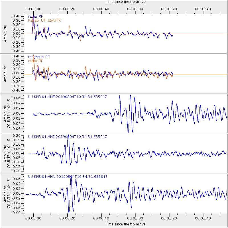
Signal To Noise
| Channel | StoN | STA | LTA |
| UU:KNB:01:HHZ:20190804T10:34:31.63501Z | 3.3677158 | 8.504658E-9 | 2.525349E-9 |
| UU:KNB:01:HHN:20190804T10:34:31.63501Z | 1.6066922 | 3.7538896E-9 | 2.3364088E-9 |
| UU:KNB:01:HHE:20190804T10:34:31.63501Z | 1.0084453 | 2.5025295E-9 | 2.481572E-9 |
| Arrivals |
| Ps | 6.3 SECOND |
| PpPs | 17 SECOND |
| PsPs/PpSs | 23 SECOND |


