
L07A Adel, OR, USA - Earthquake Result Viewer
| ||||||||||||||||||
| ||||||||||||||||||
| ||||||||||||||||||
|
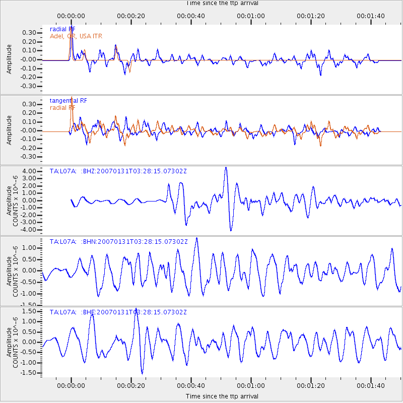
Signal To Noise
| Channel | StoN | STA | LTA |
| TA:L07A: :BHN:20070131T03:28:15.07302Z | 1.0079094 | 2.674285E-7 | 2.653299E-7 |
| TA:L07A: :BHE:20070131T03:28:15.07302Z | 1.8950536 | 5.592316E-7 | 2.9510065E-7 |
| TA:L07A: :BHZ:20070131T03:28:15.07302Z | 3.2632473 | 9.316988E-7 | 2.8551278E-7 |
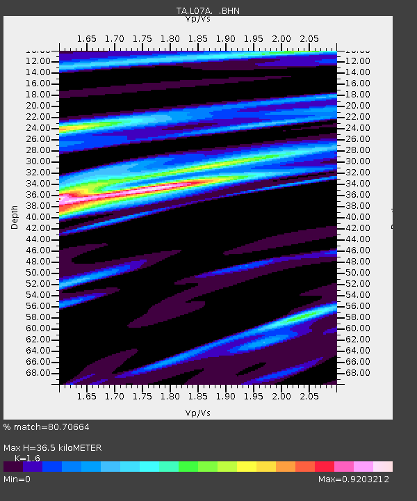
| Arrivals | |
| Ps | 3.6 SECOND |
| PpPs | 15 SECOND |
| PsPs/PpSs | 18 SECOND |

