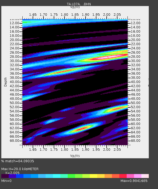
L07A Adel, OR, USA - Earthquake Result Viewer
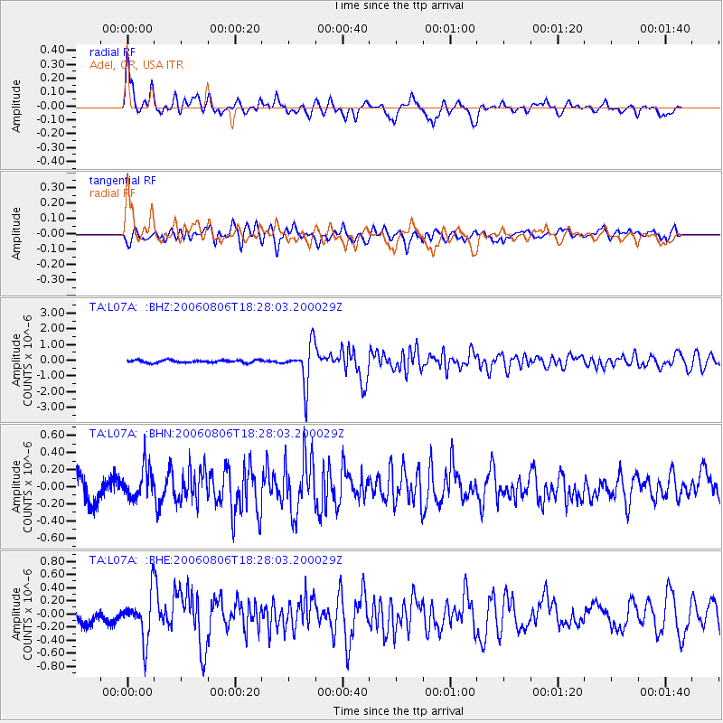
Earthquake location: Bonin Islands, Japan Region
Earthquake latitude/longitude: 26.1/144.0
Earthquake time(UTC): 2006/08/06 (218) 18:16:40 GMT
Earthquake Depth: 23 km
Earthquake Magnitude: 6.0 MB, 5.6 MS, 5.8 MW, 5.8 MW
Earthquake Catalog/Contributor: WHDF/NEIC
Network: TA USArray Transportable Network (new EarthScope stations)
Station: L07A Adel, OR, USA
Lat/Lon: 42.02 N/119.34 W
Elevation: 1816 m
Distance: 77.6 deg
Az: 49.267 deg
Baz: 293.901 deg
Ray Param: 0.050173856
Estimated Moho Depth: 28.0 km
Estimated Crust Vp/Vs: 2.01
Assumed Crust Vp: 6.279 km/s
Estimated Crust Vs: 3.131 km/s
Estimated Crust Poisson's Ratio: 0.33
Radial Match: 84.09035 %
Radial Bump: 400
Transverse Match: 72.99206 %
Transverse Bump: 400
SOD ConfigId: 2665
Insert Time: 2010-03-07 02:48:22.322 +0000
GWidth: 2.5
Max Bumps: 400
Tol: 0.001

Signal To Noise

ChannelStoNSTALTA
TA:L07A: :BHN:20060806T18:28:03.200029Z1.55898051.8483682E-71.18562625E-7
TA:L07A: :BHE:20060806T18:28:03.200029Z4.40320063.4633808E-77.865599E-8
TA:L07A: :BHZ:20060806T18:28:03.200029Z16.0625481.3068477E-68.135993E-8
Arrivals
Ps4.6 SECOND
PpPs13 SECOND
PsPs/PpSs18 SECOND