L07A Adel, OR, USA - Earthquake Result Viewer
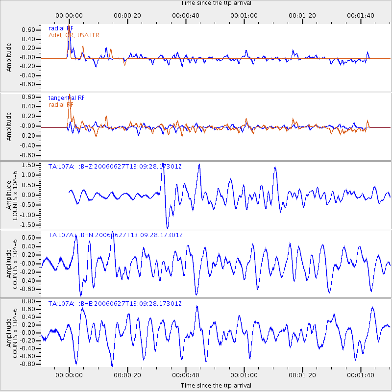
Earthquake location: Off Coast Of Chiapas, Mexico
Earthquake latitude/longitude: 15.0/-94.2
Earthquake time(UTC): 2006/06/27 (178) 13:03:12 GMT
Earthquake Depth: 29 km
Earthquake Magnitude: 5.4 MB, 5.5 MS, 5.8 MW, 5.8 MW
Earthquake Catalog/Contributor: WHDF/NEIC
Network: TA USArray Transportable Network (new EarthScope stations)
Station: L07A Adel, OR, USA
Lat/Lon: 42.02 N/119.34 W
Elevation: 1816 m
Distance: 34.6 deg
Az: 326.106 deg
Baz: 133.67 deg
Ray Param: 0.077601194
Estimated Moho Depth: 10.75 km
Estimated Crust Vp/Vs: 1.85
Assumed Crust Vp: 6.279 km/s
Estimated Crust Vs: 3.403 km/s
Estimated Crust Poisson's Ratio: 0.29
Radial Match: 85.00637 %
Radial Bump: 379
Transverse Match: 69.97294 %
Transverse Bump: 365
SOD ConfigId: 2665
Insert Time: 2010-03-07 02:48:29.895 +0000
GWidth: 2.5
Max Bumps: 400
Tol: 0.001

Signal To Noise

ChannelStoNSTALTA
TA:L07A: :BHN:20060627T13:09:28.17301Z4.56438064.1180326E-79.0221064E-8
TA:L07A: :BHE:20060627T13:09:28.17301Z3.45960434.2830857E-71.2380276E-7
TA:L07A: :BHZ:20060627T13:09:28.17301Z5.97968159.0226814E-71.50889E-7
Arrivals
Ps1.6 SECOND
PpPs4.5 SECOND
PsPs/PpSs6.1 SECOND