L07A Adel, OR, USA - Earthquake Result Viewer
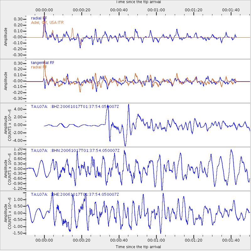
Earthquake location: New Britain Region, P.N.G.
Earthquake latitude/longitude: -5.9/151.0
Earthquake time(UTC): 2006/10/17 (290) 01:25:12 GMT
Earthquake Depth: 32 km
Earthquake Magnitude: 6.4 MB, 6.9 MS, 6.7 MW, 6.6 MW
Earthquake Catalog/Contributor: WHDF/NEIC
Network: TA USArray Transportable Network (new EarthScope stations)
Station: L07A Adel, OR, USA
Lat/Lon: 42.02 N/119.34 W
Elevation: 1816 m
Distance: 93.7 deg
Az: 48.302 deg
Baz: 265.427 deg
Ray Param: 0.041207805
Estimated Moho Depth: 67.25 km
Estimated Crust Vp/Vs: 1.63
Assumed Crust Vp: 6.279 km/s
Estimated Crust Vs: 3.84 km/s
Estimated Crust Poisson's Ratio: 0.20
Radial Match: 85.15015 %
Radial Bump: 398
Transverse Match: 70.51477 %
Transverse Bump: 400
SOD ConfigId: 2665
Insert Time: 2010-03-07 02:48:38.092 +0000
GWidth: 2.5
Max Bumps: 400
Tol: 0.001

Signal To Noise

ChannelStoNSTALTA
TA:L07A: :BHN:20061017T01:37:54.050007Z2.38814163.649463E-71.5281603E-7
TA:L07A: :BHE:20061017T01:37:54.050007Z2.2632166.5118326E-72.8772476E-7
TA:L07A: :BHZ:20061017T01:37:54.050007Z8.7812482.1638618E-62.4641847E-7
Arrivals
Ps6.9 SECOND
PpPs28 SECOND
PsPs/PpSs35 SECOND