You are here: Home > Network List > TA - USArray Transportable Network (new EarthScope stations) Stations List
> Station L07A Adel, OR, USA > Earthquake Result Viewer
L07A Adel, OR, USA - Earthquake Result Viewer
*The percent match for this event was below the threshold and hence no stack was calculated.
| Earthquake location: |
Near Coast Of Guatemala |
| Earthquake latitude/longitude: |
13.6/-90.6 |
| Earthquake time(UTC): |
2008/04/15 (106) 03:03:04 GMT |
| Earthquake Depth: |
33 km |
| Earthquake Magnitude: |
5.6 MB, 5.8 MS, 6.1 MW, 6.1 MW |
| Earthquake Catalog/Contributor: |
WHDF/NEIC |
|
| Network: |
TA USArray Transportable Network (new EarthScope stations) |
| Station: |
L07A Adel, OR, USA |
| Lat/Lon: |
42.02 N/119.34 W |
| Elevation: |
1816 m |
|
| Distance: |
37.7 deg |
| Az: |
324.17 deg |
| Baz: |
130.187 deg |
| Ray Param: |
$rayparam |
*The percent match for this event was below the threshold and hence was not used in the summary stack. |
|
| Radial Match: |
74.69053 % |
| Radial Bump: |
400 |
| Transverse Match: |
56.959946 % |
| Transverse Bump: |
400 |
| SOD ConfigId: |
2504 |
| Insert Time: |
2010-03-07 02:48:49.719 +0000 |
| GWidth: |
2.5 |
| Max Bumps: |
400 |
| Tol: |
0.001 |
|
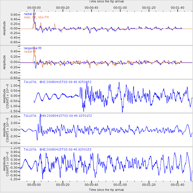
Signal To Noise
| Channel | StoN | STA | LTA |
| TA:L07A: :BHN:20080415T03:09:46.925015Z | 7.5993853 | 1.7579002E-6 | 2.3132137E-7 |
| TA:L07A: :BHE:20080415T03:09:46.925015Z | 1.5706912 | 3.3868858E-7 | 2.1563028E-7 |
| TA:L07A: :BHZ:20080415T03:09:46.925015Z | 2.581025 | 5.704616E-7 | 2.2102137E-7 |
| Arrivals |
| Ps | |
| PpPs | |
| PsPs/PpSs | |


