You are here: Home > Network List > TA - USArray Transportable Network (new EarthScope stations) Stations List
> Station G07A Ruggs Ranch, Heppner, OR, USA > Earthquake Result Viewer
G07A Ruggs Ranch, Heppner, OR, USA - Earthquake Result Viewer

| Earthquake location: |
Volcano Islands, Japan Region |
| Earthquake latitude/longitude: |
22.0/142.7 |
| Earthquake time(UTC): |
2007/09/28 (271) 13:38:59 GMT |
| Earthquake Depth: |
276 km |
| Earthquake Magnitude: |
6.7 MB, 7.4 MW, 7.4 MW |
| Earthquake Catalog/Contributor: |
WHDF/NEIC |
|
| Network: |
TA USArray Transportable Network (new EarthScope stations) |
| Station: |
G07A Ruggs Ranch, Heppner, OR, USA |
| Lat/Lon: |
45.27 N/119.67 W |
| Elevation: |
801 m |
|
| Distance: |
79.9 deg |
| Az: |
45.315 deg |
| Baz: |
290.882 deg |
| Ray Param: |
0.047960542 |
| Estimated Moho Depth: |
41.5 km |
| Estimated Crust Vp/Vs: |
1.87 |
| Assumed Crust Vp: |
6.571 km/s |
| Estimated Crust Vs: |
3.509 km/s |
| Estimated Crust Poisson's Ratio: |
0.30 |
|
| Radial Match: |
90.11235 % |
| Radial Bump: |
362 |
| Transverse Match: |
79.97 % |
| Transverse Bump: |
400 |
| SOD ConfigId: |
2564 |
| Insert Time: |
2010-03-07 02:49:18.424 +0000 |
| GWidth: |
2.5 |
| Max Bumps: |
400 |
| Tol: |
0.001 |
|
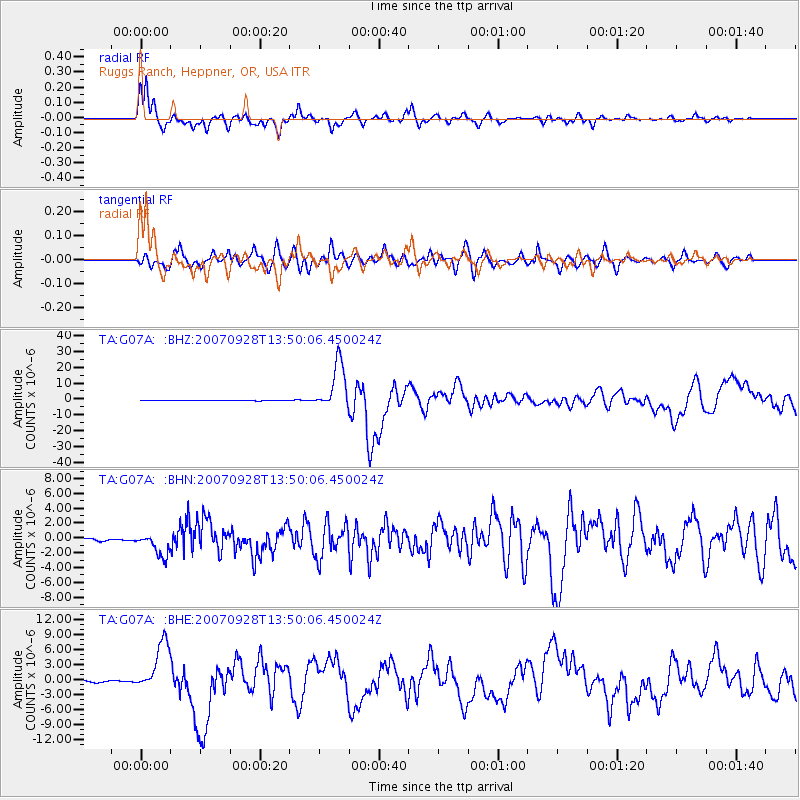
Signal To Noise
| Channel | StoN | STA | LTA |
| TA:G07A: :BHN:20070928T13:50:06.450024Z | 10.872806 | 1.5383202E-6 | 1.414833E-7 |
| TA:G07A: :BHE:20070928T13:50:06.450024Z | 32.755882 | 4.979026E-6 | 1.5200403E-7 |
| TA:G07A: :BHZ:20070928T13:50:06.450024Z | 87.08446 | 1.4839446E-5 | 1.7040291E-7 |
| Arrivals |
| Ps | 5.7 SECOND |
| PpPs | 18 SECOND |
| PsPs/PpSs | 23 SECOND |


