You are here: Home > Network List > G - GEOSCOPE Stations List
> Station MPG Montagne des Peres, French Guyana > Earthquake Result Viewer
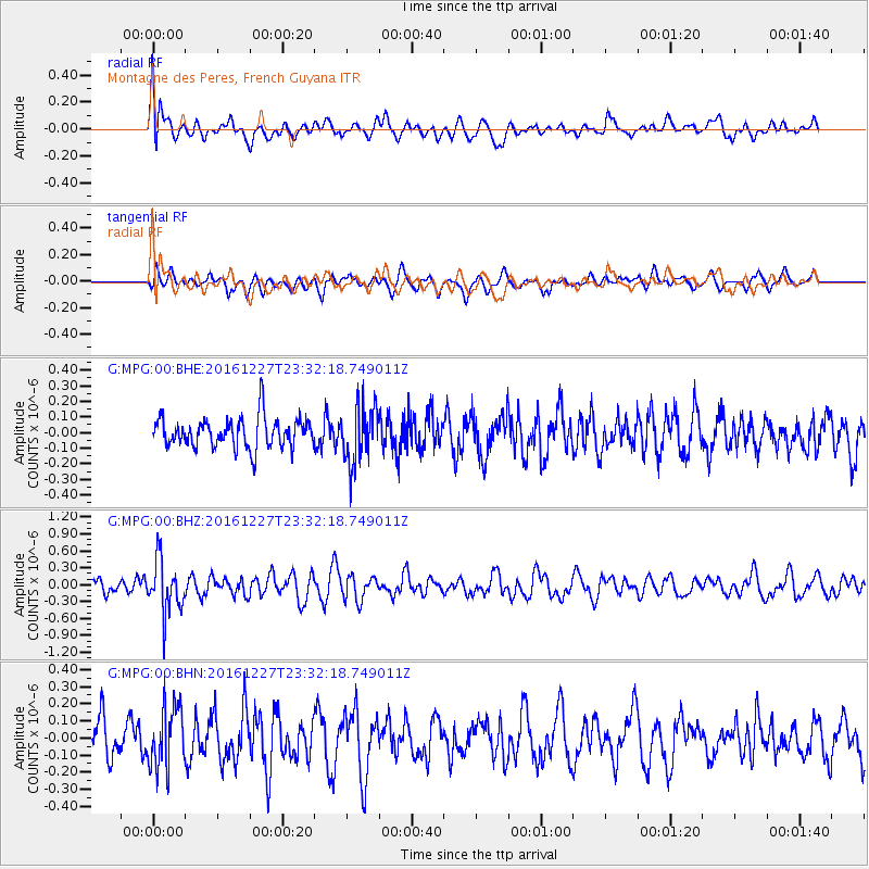
MPG Montagne des Peres, French Guyana - Earthquake Result Viewer
*The percent match for this event was below the threshold and hence no stack was calculated.
| Earthquake location: |
Romania |
| Earthquake latitude/longitude: |
45.7/26.6 |
| Earthquake time(UTC): |
2016/12/27 (362) 23:20:55 GMT |
| Earthquake Depth: |
81 km |
| Earthquake Magnitude: |
5.6 mb |
| Earthquake Catalog/Contributor: |
NEIC PDE/us |
|
| Network: |
G GEOSCOPE |
| Station: |
MPG Montagne des Peres, French Guyana |
| Lat/Lon: |
5.11 N/52.64 W |
| Elevation: |
147 m |
|
| Distance: |
78.9 deg |
| Az: |
265.874 deg |
| Baz: |
44.54 deg |
| Ray Param: |
$rayparam |
*The percent match for this event was below the threshold and hence was not used in the summary stack. |
|
| Radial Match: |
61.259945 % |
| Radial Bump: |
400 |
| Transverse Match: |
54.560184 % |
| Transverse Bump: |
400 |
| SOD ConfigId: |
1943534 |
| Insert Time: |
2017-01-10 23:22:08.638 +0000 |
| GWidth: |
2.5 |
| Max Bumps: |
400 |
| Tol: |
0.001 |
|
Signal To Noise
| Channel | StoN | STA | LTA |
| G:MPG:00:BHZ:20161227T23:32:18.749011Z | 3.4776082 | 4.6274928E-7 | 1.3306538E-7 |
| G:MPG:00:BHN:20161227T23:32:18.749011Z | 2.1319976 | 1.7946294E-7 | 8.417596E-8 |
| G:MPG:00:BHE:20161227T23:32:18.749011Z | 1.9259129 | 1.8324364E-7 | 9.5146376E-8 |
| Arrivals |
| Ps | |
| PpPs | |
| PsPs/PpSs | |


