You are here: Home > Network List > TA - USArray Transportable Network (new EarthScope stations) Stations List
> Station B18K Kokolik River, AK, USA > Earthquake Result Viewer
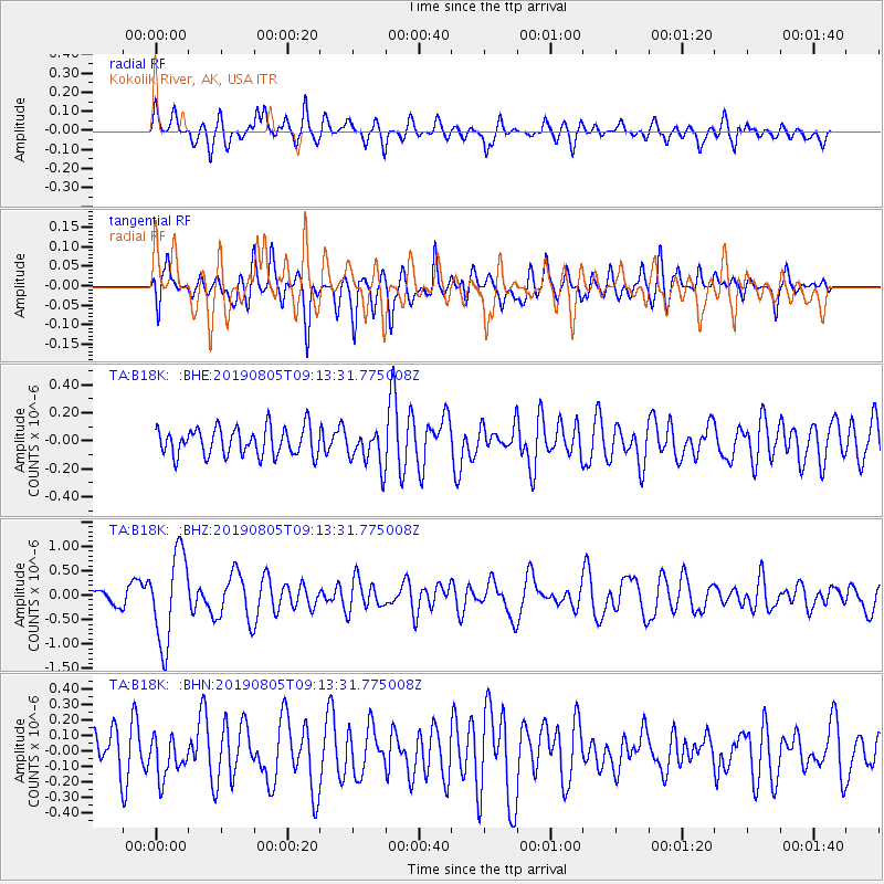
B18K Kokolik River, AK, USA - Earthquake Result Viewer
*The percent match for this event was below the threshold and hence no stack was calculated.
| Earthquake location: |
Tonga Islands |
| Earthquake latitude/longitude: |
-19.4/-174.9 |
| Earthquake time(UTC): |
2019/08/05 (217) 09:01:08 GMT |
| Earthquake Depth: |
10 km |
| Earthquake Magnitude: |
5.7 mb |
| Earthquake Catalog/Contributor: |
NEIC PDE/us |
|
| Network: |
TA USArray Transportable Network (new EarthScope stations) |
| Station: |
B18K Kokolik River, AK, USA |
| Lat/Lon: |
69.36 N/161.80 W |
| Elevation: |
222 m |
|
| Distance: |
89.0 deg |
| Az: |
4.601 deg |
| Baz: |
192.337 deg |
| Ray Param: |
$rayparam |
*The percent match for this event was below the threshold and hence was not used in the summary stack. |
|
| Radial Match: |
74.30528 % |
| Radial Bump: |
400 |
| Transverse Match: |
64.28329 % |
| Transverse Bump: |
400 |
| SOD ConfigId: |
19053131 |
| Insert Time: |
2019-08-19 09:11:16.859 +0000 |
| GWidth: |
2.5 |
| Max Bumps: |
400 |
| Tol: |
0.001 |
|
Signal To Noise
| Channel | StoN | STA | LTA |
| TA:B18K: :BHZ:20190805T09:13:31.775008Z | 6.36604 | 9.149127E-7 | 1.437177E-7 |
| TA:B18K: :BHN:20190805T09:13:31.775008Z | 1.0475194 | 1.309478E-7 | 1.2500752E-7 |
| TA:B18K: :BHE:20190805T09:13:31.775008Z | 1.3177154 | 1.3141316E-7 | 9.9728034E-8 |
| Arrivals |
| Ps | |
| PpPs | |
| PsPs/PpSs | |


