You are here: Home > Network List > US - United States National Seismic Network Stations List
> Station ERPA Erie, Pennsylvania, USA > Earthquake Result Viewer
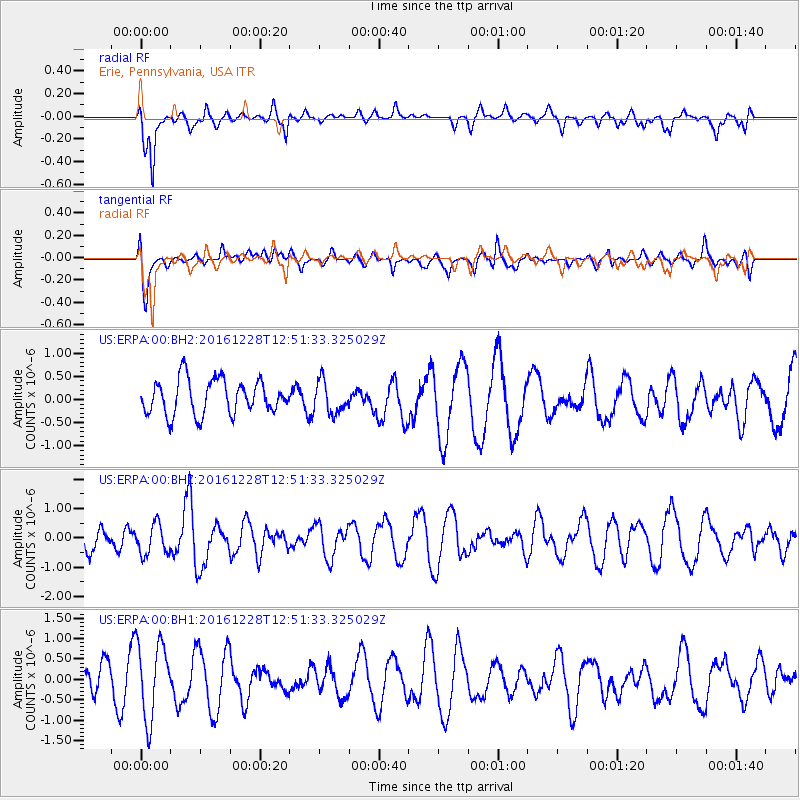
ERPA Erie, Pennsylvania, USA - Earthquake Result Viewer
*The percent match for this event was below the threshold and hence no stack was calculated.
| Earthquake location: |
Near East Coast Of Honshu, Japan |
| Earthquake latitude/longitude: |
36.9/140.4 |
| Earthquake time(UTC): |
2016/12/28 (363) 12:38:50 GMT |
| Earthquake Depth: |
10 km |
| Earthquake Magnitude: |
5.9 Mww |
| Earthquake Catalog/Contributor: |
NEIC PDE/us |
|
| Network: |
US United States National Seismic Network |
| Station: |
ERPA Erie, Pennsylvania, USA |
| Lat/Lon: |
42.12 N/79.99 W |
| Elevation: |
306 m |
|
| Distance: |
93.1 deg |
| Az: |
28.886 deg |
| Baz: |
328.644 deg |
| Ray Param: |
$rayparam |
*The percent match for this event was below the threshold and hence was not used in the summary stack. |
|
| Radial Match: |
58.950268 % |
| Radial Bump: |
378 |
| Transverse Match: |
55.221962 % |
| Transverse Bump: |
400 |
| SOD ConfigId: |
1943534 |
| Insert Time: |
2017-01-11 12:41:39.533 +0000 |
| GWidth: |
2.5 |
| Max Bumps: |
400 |
| Tol: |
0.001 |
|
Signal To Noise
| Channel | StoN | STA | LTA |
| US:ERPA:00:BHZ:20161228T12:51:33.325029Z | 1.4267396 | 5.193201E-7 | 3.639908E-7 |
| US:ERPA:00:BH1:20161228T12:51:33.325029Z | 3.4561799 | 9.3262986E-7 | 2.6984412E-7 |
| US:ERPA:00:BH2:20161228T12:51:33.325029Z | 0.926702 | 3.4288513E-7 | 3.7000584E-7 |
| Arrivals |
| Ps | |
| PpPs | |
| PsPs/PpSs | |


