You are here: Home > Network List > TA - USArray Transportable Network (new EarthScope stations) Stations List
> Station A21K Barrow, AK, USA > Earthquake Result Viewer
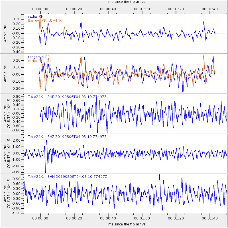
A21K Barrow, AK, USA - Earthquake Result Viewer
*The percent match for this event was below the threshold and hence no stack was calculated.
| Earthquake location: |
Northern Molucca Sea |
| Earthquake latitude/longitude: |
2.2/126.5 |
| Earthquake time(UTC): |
2019/08/06 (218) 03:51:16 GMT |
| Earthquake Depth: |
32 km |
| Earthquake Magnitude: |
5.2 Mww |
| Earthquake Catalog/Contributor: |
NEIC PDE/us |
|
| Network: |
TA USArray Transportable Network (new EarthScope stations) |
| Station: |
A21K Barrow, AK, USA |
| Lat/Lon: |
71.32 N/156.62 W |
| Elevation: |
577 m |
|
| Distance: |
83.8 deg |
| Az: |
18.399 deg |
| Baz: |
258.226 deg |
| Ray Param: |
$rayparam |
*The percent match for this event was below the threshold and hence was not used in the summary stack. |
|
| Radial Match: |
61.691555 % |
| Radial Bump: |
400 |
| Transverse Match: |
60.3904 % |
| Transverse Bump: |
400 |
| SOD ConfigId: |
19053131 |
| Insert Time: |
2019-08-20 03:54:29.995 +0000 |
| GWidth: |
2.5 |
| Max Bumps: |
400 |
| Tol: |
0.001 |
|
Signal To Noise
| Channel | StoN | STA | LTA |
| TA:A21K: :BHZ:20190806T04:03:10.77497Z | 3.4873972 | 1.0687914E-6 | 3.0647254E-7 |
| TA:A21K: :BHN:20190806T04:03:10.77497Z | 1.1434542 | 3.3743103E-7 | 2.9509798E-7 |
| TA:A21K: :BHE:20190806T04:03:10.77497Z | 1.2906126 | 4.1459694E-7 | 3.2124044E-7 |
| Arrivals |
| Ps | |
| PpPs | |
| PsPs/PpSs | |


