You are here: Home > Network List > TA - USArray Transportable Network (new EarthScope stations) Stations List
> Station F21K Alatna River, AK, USA > Earthquake Result Viewer
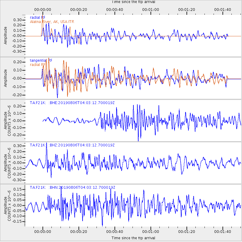
F21K Alatna River, AK, USA - Earthquake Result Viewer
*The percent match for this event was below the threshold and hence no stack was calculated.
| Earthquake location: |
Northern Molucca Sea |
| Earthquake latitude/longitude: |
2.2/126.5 |
| Earthquake time(UTC): |
2019/08/06 (218) 03:51:16 GMT |
| Earthquake Depth: |
32 km |
| Earthquake Magnitude: |
5.2 Mww |
| Earthquake Catalog/Contributor: |
NEIC PDE/us |
|
| Network: |
TA USArray Transportable Network (new EarthScope stations) |
| Station: |
F21K Alatna River, AK, USA |
| Lat/Lon: |
67.22 N/153.48 W |
| Elevation: |
597 m |
|
| Distance: |
84.1 deg |
| Az: |
22.673 deg |
| Baz: |
261.608 deg |
| Ray Param: |
$rayparam |
*The percent match for this event was below the threshold and hence was not used in the summary stack. |
|
| Radial Match: |
63.094933 % |
| Radial Bump: |
400 |
| Transverse Match: |
53.51814 % |
| Transverse Bump: |
400 |
| SOD ConfigId: |
19053131 |
| Insert Time: |
2019-08-20 03:54:47.761 +0000 |
| GWidth: |
2.5 |
| Max Bumps: |
400 |
| Tol: |
0.001 |
|
Signal To Noise
| Channel | StoN | STA | LTA |
| TA:F21K: :BHZ:20190806T04:03:12.700019Z | 2.5360827 | 1.2122739E-7 | 4.7801034E-8 |
| TA:F21K: :BHN:20190806T04:03:12.700019Z | 1.4789324 | 4.1809066E-8 | 2.8269762E-8 |
| TA:F21K: :BHE:20190806T04:03:12.700019Z | 2.7677202 | 6.408865E-8 | 2.3155758E-8 |
| Arrivals |
| Ps | |
| PpPs | |
| PsPs/PpSs | |


