You are here: Home > Network List > TA - USArray Transportable Network (new EarthScope stations) Stations List
> Station H16K Elim, AK, USA > Earthquake Result Viewer
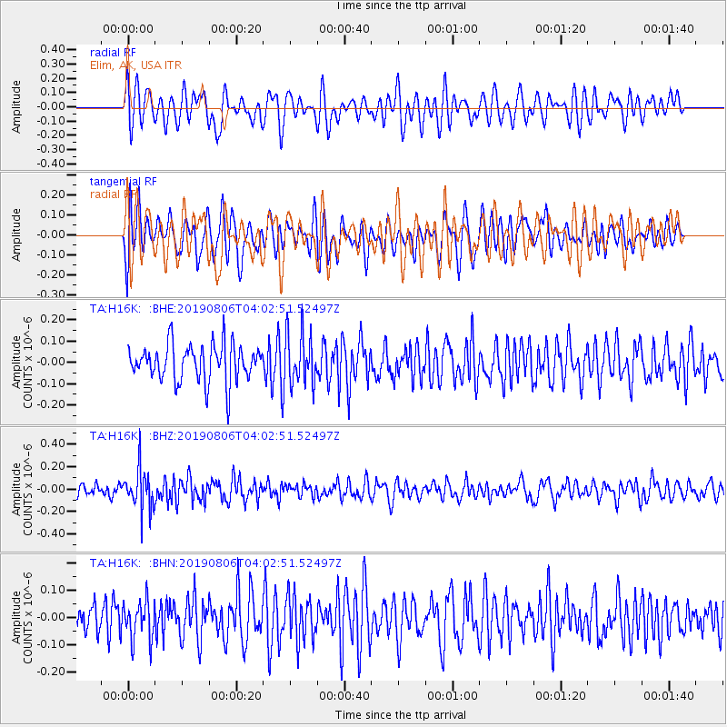
H16K Elim, AK, USA - Earthquake Result Viewer
*The percent match for this event was below the threshold and hence no stack was calculated.
| Earthquake location: |
Northern Molucca Sea |
| Earthquake latitude/longitude: |
2.2/126.5 |
| Earthquake time(UTC): |
2019/08/06 (218) 03:51:16 GMT |
| Earthquake Depth: |
32 km |
| Earthquake Magnitude: |
5.2 Mww |
| Earthquake Catalog/Contributor: |
NEIC PDE/us |
|
| Network: |
TA USArray Transportable Network (new EarthScope stations) |
| Station: |
H16K Elim, AK, USA |
| Lat/Lon: |
64.64 N/162.24 W |
| Elevation: |
216 m |
|
| Distance: |
80.1 deg |
| Az: |
24.457 deg |
| Baz: |
253.863 deg |
| Ray Param: |
$rayparam |
*The percent match for this event was below the threshold and hence was not used in the summary stack. |
|
| Radial Match: |
53.54974 % |
| Radial Bump: |
400 |
| Transverse Match: |
50.693966 % |
| Transverse Bump: |
400 |
| SOD ConfigId: |
19053131 |
| Insert Time: |
2019-08-20 03:54:58.126 +0000 |
| GWidth: |
2.5 |
| Max Bumps: |
400 |
| Tol: |
0.001 |
|
Signal To Noise
| Channel | StoN | STA | LTA |
| TA:H16K: :BHZ:20190806T04:02:51.52497Z | 2.6403022 | 1.8116623E-7 | 6.861572E-8 |
| TA:H16K: :BHN:20190806T04:02:51.52497Z | 0.88698876 | 7.111347E-8 | 8.017403E-8 |
| TA:H16K: :BHE:20190806T04:02:51.52497Z | 1.3961226 | 1.210871E-7 | 8.673099E-8 |
| Arrivals |
| Ps | |
| PpPs | |
| PsPs/PpSs | |


